Štětí night lights from space
Night Light of Štětí (Ústecký kraj) from space (Czech Republic) Src. Average luminocity for 10x10km area is 8.8179% and for 50x50km: 4.581%.
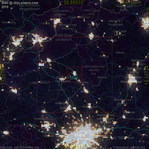
Analysis of Štětí night lights 2016
Square area 10x10 km:
 1.96%
1.96%90-99
2.1%80-89
0.56%70-79
0.42%60-69
0.7%50-59
0.14%40-49
0.56%30-39
1.4%20-29
2.52%10-19
0.56%0-9
89.08%Square area 50x50 km:
0.92%90-99
1.01%80-89
0.35%70-79
0.3%60-69
0.44%50-59
0.26%40-49
0.36%30-39
0.33%20-29
0.75%10-19
2.3%0-9
92.96%Clear (daylight) street map image can be seen on geolist.org.
Map coordinates:
50° 53' 54.8" North, 13° 40' 15.9" East
50° 27' 10.7" North, 14° 22' 27.2" East
50° 0' 11.4" North, 15° 4' 38.4" East
Some cities around Štětí sort by population:
• Česká Lípa
28.3 km =17.6 mi,  24°
24°
• Litoměřice
19.3 km =12 mi,  297°
297°
• Mělník
13.4 km =8.3 mi,  148°
148°
• Kralupy nad Vltavou
24 km =14.9 mi,  190°
190°
• Neratovice
23.8 km =14.8 mi, 154°
• Roudnice nad Labem
8.5 km =5.3 mi,  248°
248°
• Lovosice
23.9 km =14.9 mi,  286°
286°
• Doksy
23.5 km =14.6 mi,  58°
58°
3065163 (p: 9,165)
Sources (retrieved 2019-11-25):
» Earth at Night: Flat Maps 2012, 2016