Šternberk night lights from space
Night Light of Šternberk (Olomoucký) from space (Czech Republic) Src. Average luminocity for 10x10km area is 4.9251% and for 50x50km: 5.0479%.
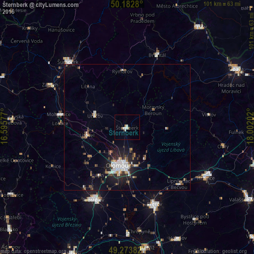
Analysis of Šternberk night lights 2016
Square area 10x10 km:
 1.07%
1.07%90-99
1.6%80-89
0%70-79
0.53%60-69
0%50-59
1.07%40-49
0%30-39
0.27%20-29
0.27%10-19
0%0-9
95.19%Square area 50x50 km:
0.79%90-99
0.91%80-89
0.28%70-79
0.34%60-69
0.49%50-59
0.77%40-49
0.68%30-39
0.84%20-29
1.66%10-19
3.35%0-9
89.9%Clear (daylight) street map image can be seen on geolist.org.
Map coordinates:
50° 10' 58.1" North, 16° 35' 44.8" East
49° 43' 49.6" North, 17° 17' 56" East
49° 16' 25.8" North, 18° 0' 7.3" East
Some cities around Šternberk sort by population:
• Olomouc
15.4 km =9.6 mi,  192°
192°
• Prostějov
31.8 km =19.8 mi,  205°
205°
• Bruntál
31.1 km =19.3 mi,  22°
22°
• Uničov
13.5 km =8.4 mi,  289°
289°
• Litovel
16.3 km =10.1 mi,  258°
258°
• Mohelnice
27.7 km =17.2 mi,  280°
280°
• Rýmařov
22.5 km =14 mi,  355°
355°
• Lipník nad Bečvou
30.6 km =19 mi,  137°
137°
3065166 (p: 13,967)
Sources (retrieved 2019-11-25):
» Earth at Night: Flat Maps 2012, 2016