Rýmařov night lights from space
Night Light of Rýmařov (Moravskoslezský) from space (Czech Republic) Src. Average luminocity for 10x10km area is 1.6513% and for 50x50km: 1.6705%.
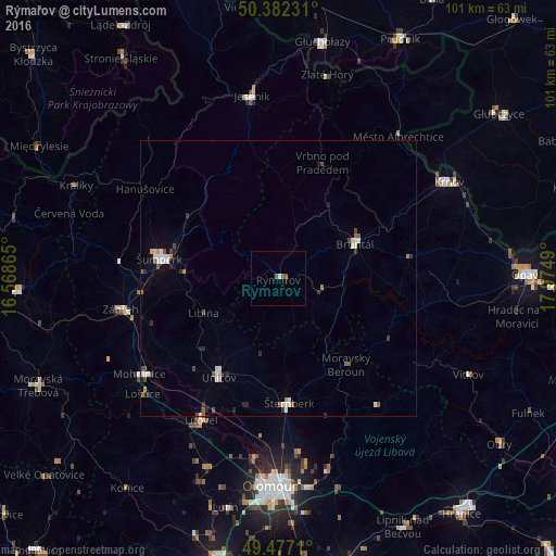
Analysis of Rýmařov night lights 2016
Square area 10x10 km:
 0%
0%90-99
0.56%80-89
0%70-79
0%60-69
0%50-59
1.12%40-49
0.56%30-39
0%20-29
0%10-19
0.56%0-9
97.2%Square area 50x50 km:
0.26%90-99
0.38%80-89
0.07%70-79
0.11%60-69
0.11%50-59
0.36%40-49
0.21%30-39
0.21%20-29
0.34%10-19
0.38%0-9
97.57%Clear (daylight) street map image can be seen on geolist.org.
Map coordinates:
50° 22' 56.3" North, 16° 34' 7.1" East
49° 55' 54.6" North, 17° 16' 18.4" East
49° 28' 37.6" North, 17° 58' 29.6" East
Some cities around Rýmařov sort by population:
• Šumperk
21.9 km =13.6 mi,  279°
279°
• Bruntál
15.2 km =9.4 mi,  65°
65°
• Zábřeh
29.1 km =18.1 mi,  259°
259°
• Šternberk
22.5 km =14 mi,  175°
175°
• Uničov
20.9 km =13 mi,  211°
211°
• Litovel
29.2 km =18.1 mi, 208°
• Mohelnice
30.6 km =19 mi,  235°
235°
• Vrbno pod Pradědem
22.5 km =14 mi,  20°
20°
3066483 (p: 9,069)
Sources (retrieved 2019-11-25):
» Earth at Night: Flat Maps 2012, 2016