Přeštice night lights from space
Night Light of Přeštice (Plzeňský kraj) from space (Czech Republic) Src. Average luminocity for 10x10km area is 4.1793% and for 50x50km: 6.1673%.
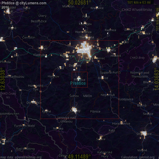
Analysis of Přeštice night lights 2016
Square area 10x10 km:
 0.56%
0.56%90-99
1.12%80-89
1.12%70-79
0%60-69
0%50-59
0.56%40-49
0.56%30-39
0%20-29
0%10-19
0%0-9
96.08%Square area 50x50 km:
1.34%90-99
1.29%80-89
0.47%70-79
0.49%60-69
0.6%50-59
0.69%40-49
0.61%30-39
0.62%20-29
1.58%10-19
2.84%0-9
89.46%Clear (daylight) street map image can be seen on geolist.org.
Map coordinates:
50° 1' 36.5" North, 12° 37' 49.4" East
49° 34' 22.7" North, 13° 20' 0.6" East
49° 6' 53.6" North, 14° 2' 11.9" East
Some cities around Přeštice sort by population:
• Pilsen
19.7 km =12.2 mi,  9°
9°
• Klatovy
19.9 km =12.4 mi,  188°
188°
• Rokycany
26.6 km =16.5 mi,  44°
44°
• Domažlice
32.7 km =20.3 mi,  243°
243°
• Stříbro
31.6 km =19.6 mi,  309°
309°
• Nýřany
17.7 km =11 mi,  330°
330°
• Dobřany
9.6 km =6 mi,  342°
342°
• Nýrsko
33.9 km =21.1 mi,  203°
203°
3067553 (p: 6,353)
Sources (retrieved 2019-11-25):
» Earth at Night: Flat Maps 2012, 2016