Rokycany night lights from space
Night Light of Rokycany (Plzeňský kraj) from space (Czech Republic) Src. Average luminocity for 10x10km area is 9.8035% and for 50x50km: 5.8004%.
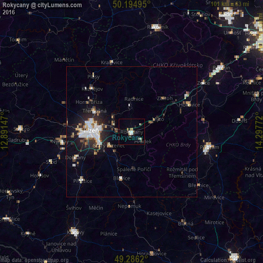
Analysis of Rokycany night lights 2016
Square area 10x10 km:
 2.14%
2.14%90-99
1.6%80-89
0.53%70-79
1.2%60-69
0.8%50-59
0.13%40-49
1.07%30-39
1.47%20-29
2.41%10-19
0.94%0-9
87.7%Square area 50x50 km:
1.17%90-99
1.13%80-89
0.42%70-79
0.51%60-69
0.45%50-59
0.61%40-49
0.68%30-39
0.77%20-29
1.82%10-19
3.43%0-9
89%Clear (daylight) street map image can be seen on geolist.org.
Map coordinates:
50° 11' 41.8" North, 12° 53' 29.3" East
49° 44' 33.7" North, 13° 35' 40.5" East
49° 17' 10.3" North, 14° 17' 51.8" East
Some cities around Rokycany sort by population:
• Pilsen
15.6 km =9.7 mi,  271°
271°
• Příbram
30.5 km =19 mi,  101°
101°
• Nýřany
27.7 km =17.2 mi,  262°
262°
• Blatná
41 km =25.5 mi,  149°
149°
• Hořovice
24.4 km =15.2 mi,  64°
64°
• Přeštice
26.6 km =16.5 mi,  224°
224°
• Králův Dvůr
39.1 km =24.3 mi,  53°
53°
• Dobřany
23.8 km =14.8 mi,  245°
245°
3066794 (p: 13,826)
Sources (retrieved 2019-11-25):
» Earth at Night: Flat Maps 2012, 2016