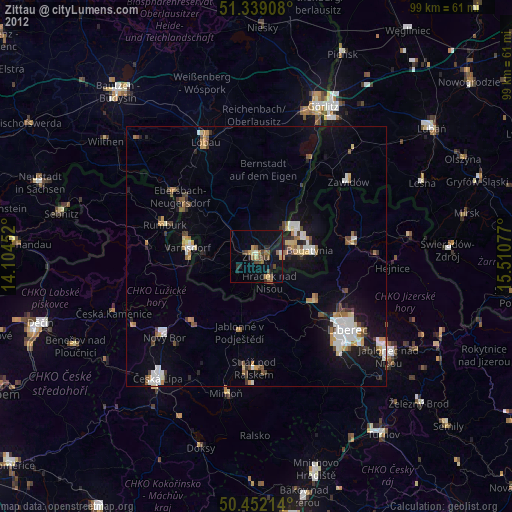
Zittau night lights from space
Night Light of Zittau (Saxony) from space (Germany) Src. Average luminocity for 10x10km area is 11.1345% and for 50x50km: 6.4502%.
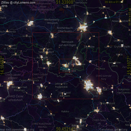
Analysis of Zittau night lights 2016
Square area 10x10 km:
 0.28%
0.28%90-99
0.84%80-89
1.68%70-79
0.42%60-69
3.22%50-59
2.52%40-49
1.96%30-39
2.24%20-29
0.56%10-19
0.84%0-9
85.43%Square area 50x50 km:
1.24%90-99
1.23%80-89
0.37%70-79
0.58%60-69
0.6%50-59
0.73%40-49
0.59%30-39
0.69%20-29
1.05%10-19
5.08%0-9
87.83%Clear (daylight) street map image can be seen on geolist.org.
Map coordinates:
51° 20' 20.7" North, 14° 6' 16.3" East
50° 53' 51.8" North, 14° 48' 27.5" East
50° 27' 7.7" North, 15° 30' 38.8" East
Some cities around Zittau sort by population:
• Bogatynia, PL
10.5 km =6.5 mi,  84°
84°
• Varnsdorf, CZ
13.4 km =8.3 mi,  276°
276°
• Hrádek nad Nisou, CZ
5.6 km =3.5 mi,  152°
152°
• Großschönau
8.7 km =5.4 mi,  271°
271°
• Neugersdorf
16.5 km =10.3 mi,  302°
302°
• Chrastava, CZ
14.4 km =8.9 mi,  128°
128°
• Olbersdorf
3.8 km =2.4 mi,  223°
223°
• Eibau
13.9 km =8.6 mi,  312°
312°
2804008 (p: 25,785)
Sources (retrieved 2019-11-25):
» Earth at Night: Flat Maps 2012, 2016