Bogatynia night lights from space
Night Light of Bogatynia (Lower Silesia) from space (Poland) Src. Average luminocity for 10x10km area is 21.9944% and for 50x50km: 6.2974%.
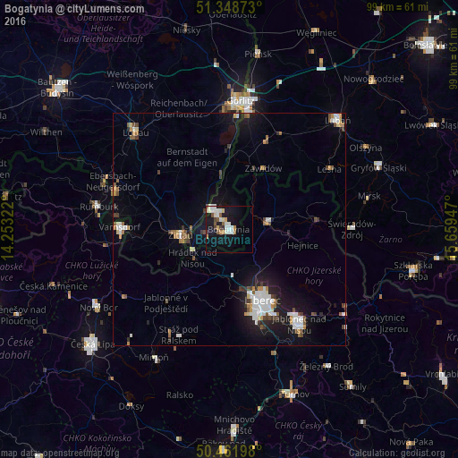
Analysis of Bogatynia night lights 2016
Square area 10x10 km:
 4.62%
4.62%90-99
5.32%80-89
1.68%70-79
2.38%60-69
0.98%50-59
3.36%40-49
1.54%30-39
1.4%20-29
1.12%10-19
22.55%0-9
55.04%Square area 50x50 km:
1.23%90-99
1.11%80-89
0.36%70-79
0.56%60-69
0.66%50-59
0.77%40-49
0.63%30-39
0.7%20-29
1.06%10-19
5.24%0-9
87.68%Clear (daylight) street map image can be seen on geolist.org.
Map coordinates:
51° 20' 55.4" North, 14° 15' 11.6" East
50° 54' 26.9" North, 14° 57' 22.8" East
50° 27' 43.1" North, 15° 39' 34.1" East
Some cities around Bogatynia sort by population:
• Liberec, CZ
17.1 km =10.6 mi,  155°
155°
• Zittau, DE
10.5 km =6.5 mi,  264°
264°
• Frýdlant, CZ
8.8 km =5.5 mi,  79°
79°
• Hrádek nad Nisou, CZ
9.9 km =6.2 mi,  232°
232°
• Großschönau, DE
19.2 km =11.9 mi,  267°
267°
• Chrastava, CZ
10.1 km =6.3 mi,  175°
175°
• Olbersdorf, DE
13.6 km =8.5 mi,  253°
253°
• Eibau, DE
22.2 km =13.8 mi,  292°
292°
3103096 (p: 18,688)
Sources (retrieved 2019-11-25):
» Earth at Night: Flat Maps 2012, 2016