Liberec night lights from space
Night Light of Liberec (Liberecký kraj) from space (Czech Republic) Src. Average luminocity for 10x10km area is 47.8417% and for 50x50km: 5.7797%.
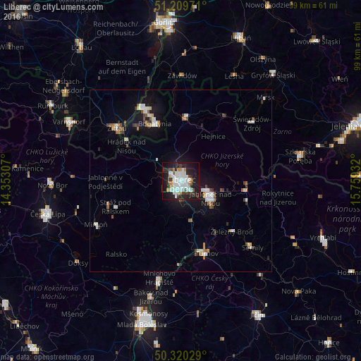
Analysis of Liberec night lights 2016
Square area 10x10 km:
 16.53%
90-99
11.34%80-89
2.38%70-79
4.2%60-69
2.52%50-59
2.52%40-49
3.78%30-39
5.32%20-29
16.67%10-19
29.83%0-9
4.9%Square area 50x50 km:
1.24%90-99
1.07%80-89
0.41%70-79
0.46%60-69
0.41%50-59
0.67%40-49
0.53%30-39
0.68%20-29
1%10-19
4.66%0-9
88.87%Clear (daylight) street map image can be seen on geolist.org.
Map coordinates:
51° 12' 35" North, 14° 21' 11.1" East
50° 46' 1.6" North, 15° 3' 22.3" East
50° 19' 13" North, 15° 45' 33.6" East
Some cities around Liberec sort by population:
• Jablonec nad Nisou
9.4 km =5.8 mi,  120°
120°
• Bogatynia, PL
17.1 km =10.6 mi,  335°
335°
• Turnov
21.5 km =13.4 mi,  161°
161°
• Frýdlant
17.2 km =10.7 mi,  5°
5°
• Hrádek nad Nisou
17.7 km =11 mi,  302°
302°
• Tanvald
17.9 km =11.1 mi,  100°
100°
• Železný Brod
19.6 km =12.2 mi,  134°
134°
• Chrastava
8.3 km =5.2 mi,  312°
312°
3071961 (p: 97,770)
Sources (retrieved 2019-11-25):
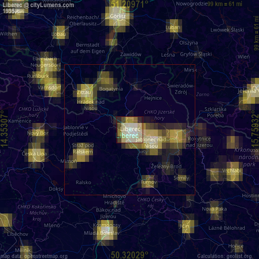
» NASA, Earths city lights 1995
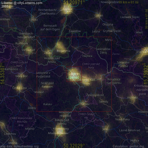
» NASA city lights 2003
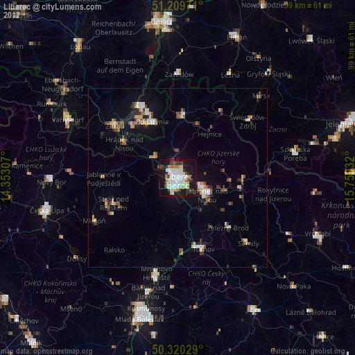
» Earth at Night: Flat Maps 2012, 2016