Frýdek-Místek night lights from space
Night Light of Frýdek-Místek (Moravskoslezský) from space (Czech Republic) Src. Average luminocity for 10x10km area is 27.5668% and for 50x50km: 15.3108%.
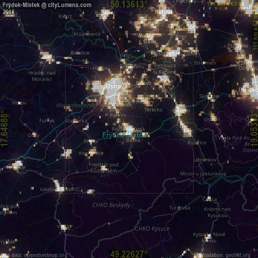
Analysis of Frýdek-Místek night lights 2016
Square area 10x10 km:
 4.41%
4.41%90-99
4.68%80-89
1.74%70-79
3.34%60-69
2.94%50-59
2.67%40-49
2.14%30-39
3.88%20-29
6.55%10-19
41.18%0-9
26.47%Square area 50x50 km:
2.63%90-99
2.72%80-89
1.31%70-79
1.44%60-69
1.71%50-59
1.98%40-49
2.09%30-39
2.2%20-29
4.59%10-19
12.68%0-9
66.65%Clear (daylight) street map image can be seen on geolist.org.
Map coordinates:
50° 8' 10.1" North, 17° 38' 48.8" East
49° 40' 60" North, 18° 21' 0" East
49° 13' 34.6" North, 19° 3' 11.3" East
Some cities around Frýdek-Místek sort by population:
• Ostrava
17.5 km =10.9 mi,  343°
343°
• Havířov
12.4 km =7.7 mi,  30°
30°
• Kopřivnice
17.5 km =10.9 mi,  237°
237°
• Frýdlant nad Ostravicí
10.1 km =6.3 mi,  176°
176°
• Příbor
15.5 km =9.6 mi,  252°
252°
• Petřvald
16.7 km =10.4 mi,  9°
9°
• Vratimov
10 km =6.2 mi, 343°
• Šenov
12.4 km =7.7 mi, 8°
3076127 (p: 59,416)
Sources (retrieved 2019-11-25):
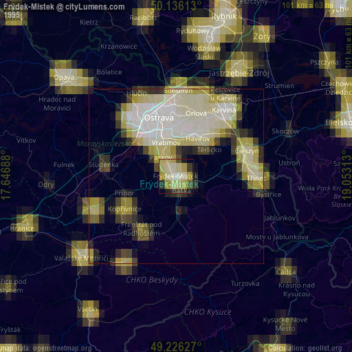
» NASA, Earths city lights 1995
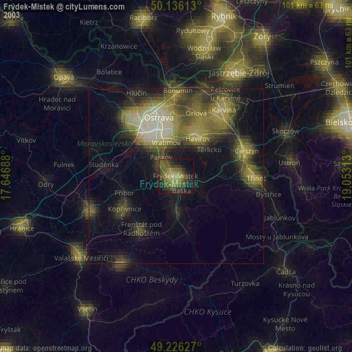
» NASA city lights 2003
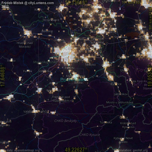
» Earth at Night: Flat Maps 2012, 2016