Kopřivnice night lights from space
Night Light of Kopřivnice (Moravskoslezský) from space (Czech Republic) Src. Average luminocity for 10x10km area is 11.7283% and for 50x50km: 8.8721%.
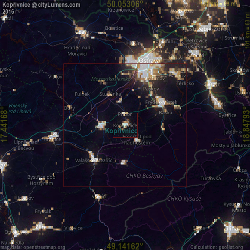
Analysis of Kopřivnice night lights 2016
Square area 10x10 km:
 1.26%
1.26%90-99
1.68%80-89
1.12%70-79
0.98%60-69
2.52%50-59
1.96%40-49
0.14%30-39
1.82%20-29
0.56%10-19
2.94%0-9
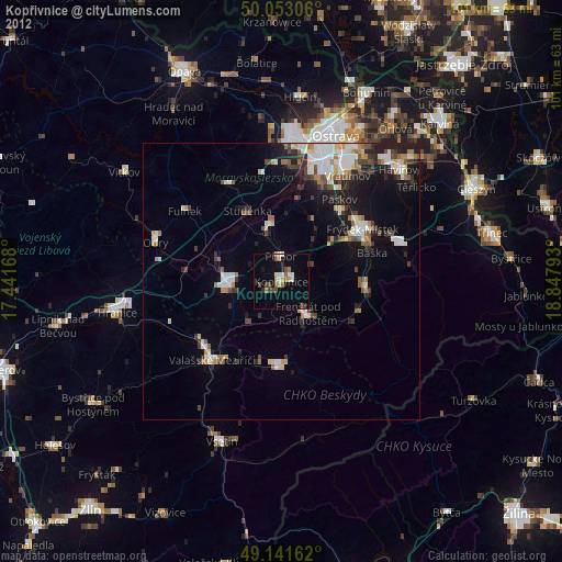
85.01%Square area 50x50 km:
1.42%90-99
1.59%80-89
0.77%70-79
0.85%60-69
1.14%50-59
1.17%40-49
1.18%30-39
1.26%20-29
2.17%10-19
5.59%0-9
82.86%Clear (daylight) street map image can be seen on geolist.org.
Map coordinates:
50° 3' 11" North, 17° 26' 30" East
49° 35' 58.1" North, 18° 8' 41.3" East
49° 8' 29.8" North, 18° 50' 52.5" East
Some cities around Kopřivnice sort by population:
• Frýdek-Místek
17.5 km =10.9 mi,  57°
57°
• Nový Jičín
9.7 km =6 mi,  266°
266°
• Rožnov pod Radhoštěm
15.7 km =9.8 mi,  180°
180°
• Frenštát pod Radhoštěm
7.4 km =4.6 mi,  140°
140°
• Studénka
14.6 km =9.1 mi,  340°
340°
• Frýdlant nad Ostravicí
15.5 km =9.6 mi,  92°
92°
• Příbor
4.6 km =2.9 mi,  0°
0°
• Zubří
15.3 km =9.5 mi,  194°
194°
3073254 (p: 23,424)
Sources (retrieved 2019-11-25):
» Earth at Night: Flat Maps 2012, 2016