Frýdlant nad Ostravicí night lights from space
Night Light of Frýdlant nad Ostravicí (Moravskoslezský) from space (Czech Republic) Src. Average luminocity for 10x10km area is 3.3305% and for 50x50km: 9.2988%.
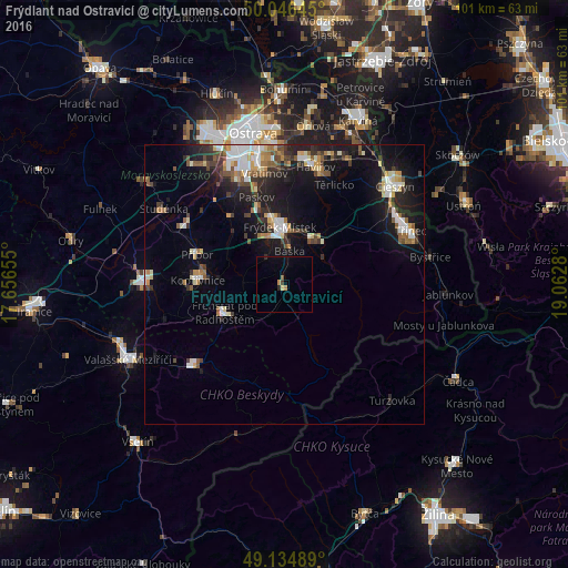
Analysis of Frýdlant nad Ostravicí night lights 2016
Square area 10x10 km:
 0%
0%90-99
0%80-89
0.56%70-79
0.42%60-69
0.7%50-59
0.56%40-49
0%30-39
0.56%20-29
0.84%10-19
0.14%0-9
96.22%Square area 50x50 km:
1.36%90-99
1.6%80-89
0.85%70-79
0.83%60-69
1.12%50-59
1.22%40-49
1.32%30-39
1.28%20-29
2.46%10-19
7.86%0-9
80.1%Clear (daylight) street map image can be seen on geolist.org.
Map coordinates:
50° 2' 47.2" North, 17° 39' 23.6" East
49° 35' 34.1" North, 18° 21' 34.8" East
49° 8' 5.6" North, 19° 3' 46.1" East
Some cities around Frýdlant nad Ostravicí sort by population:
• Havířov
21.5 km =13.4 mi,  14°
14°
• Frýdek-Místek
10.1 km =6.3 mi,  356°
356°
• Kopřivnice
15.5 km =9.6 mi,  272°
272°
• Rožnov pod Radhoštěm
21.6 km =13.4 mi,  226°
226°
• Frenštát pod Radhoštěm
11.8 km =7.3 mi,  245°
245°
• Příbor
16.4 km =10.2 mi,  289°
289°
• Vratimov
20 km =12.4 mi,  349°
349°
• Šenov
22.3 km =13.9 mi,  3°
3°
3076123 (p: 9,824)
Sources (retrieved 2019-11-25):
» Earth at Night: Flat Maps 2012, 2016