Willemstad night lights from space
Night Light of Willemstad from space (Curacao) Src. Average luminocity for 10x10km area is 61.2913% and for 50x50km: 7.5565%.
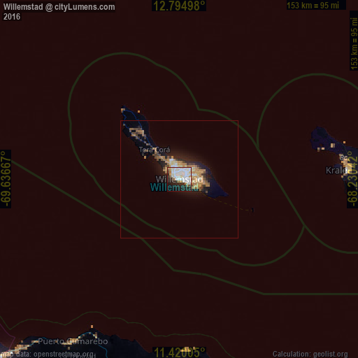
Analysis of Willemstad night lights 2016
Square area 10x10 km:
 18.39%
90-99
25%80-89
3.72%70-79
4.96%60-69
2.69%50-59
1.45%40-49
2.89%30-39
4.13%20-29
16.53%10-19
14.88%0-9
5.37%Square area 50x50 km:
0.84%90-99
1.38%80-89
0.72%70-79
1.41%60-69
1.46%50-59
0.61%40-49
0.98%30-39
0.95%20-29
2.05%10-19
4.74%0-9
84.87%Clear (daylight) street map image can be seen on geolist.org.
Map coordinates:
12° 47' 41.9" North, 69° 38' 12" West
12° 6' 30.2" North, 68° 56' 0.7" West
11° 25' 12.2" North, 68° 13' 49.5" West
Some cities around Willemstad sort by population:
• Coro, VE
112.3 km =69.8 mi,  225°
225°
• Tanki Leendert, AW
127.4 km =79.2 mi,  292°
292°
• San Nicolas, AW
111.9 km =69.5 mi, 289°
• Santa Cruz, AW
122.2 km =75.9 mi, 291°
• Paradera, AW
125.9 km =78.2 mi, 292°
• Savaneta, AW
115.6 km =71.8 mi, 289°
• Sint Michiel Liber
7.1 km =4.4 mi,  310°
310°
• Kralendijk, BQ
72.6 km =45.1 mi,  86°
86°
3513090 (p: 125,000)
Sources (retrieved 2019-11-25):
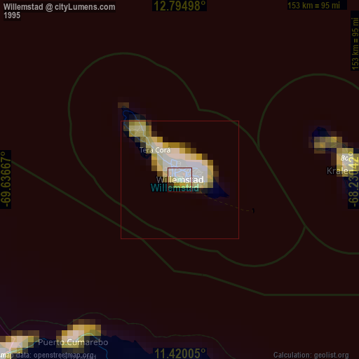
» NASA, Earths city lights 1995
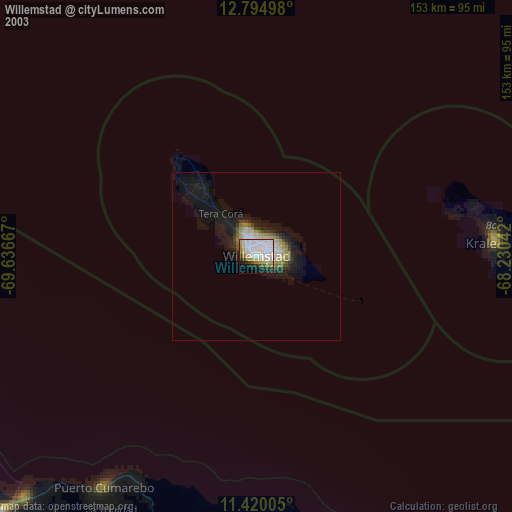
» NASA city lights 2003
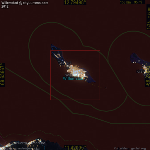
» Earth at Night: Flat Maps 2012, 2016