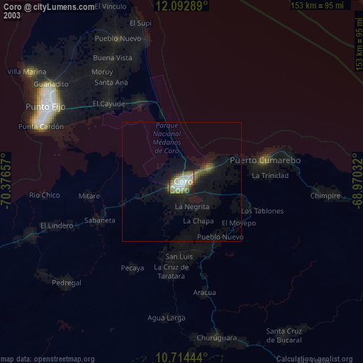
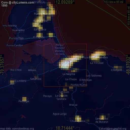
Coro night lights from space
Night Light of Coro (Falcón) from space (Venezuela) Src. Average luminocity for 10x10km area is 58.368% and for 50x50km: 4.6298%.
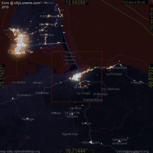
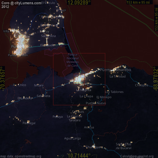
Analysis of Coro night lights 2016
Square area 10x10 km:
 18.83%
90-99
14.07%80-89
2.16%70-79
4.98%60-69
10.17%50-59
3.46%40-49
4.98%30-39
8.44%20-29
20.13%10-19
12.55%0-9
0.22%Square area 50x50 km:
0.76%90-99
0.59%80-89
0.08%70-79
0.31%60-69
1.31%50-59
0.56%40-49
0.62%30-39
0.59%20-29
1.39%10-19
4.04%0-9
89.74%Clear (daylight) street map image can be seen on geolist.org.
Map coordinates:
12° 5' 34.4" North, 70° 22' 35.7" West
11° 24' 16.2" North, 69° 40' 24.4" West
10° 42' 52" North, 68° 58' 13.2" West
Some cities around Coro sort by population:
• Punto Fijo
65.6 km =40.8 mi,  299°
299°
• Willemstad, CW
112.3 km =69.8 mi,  45°
45°
• Punta Cardón
65.4 km =40.6 mi, 295°
• Oranjestad, AW
130.3 km =81 mi,  342°
342°
• San Nicolas, AW
117.5 km =73 mi,  347°
347°
• Santa Cruz, AW
127.3 km =79.1 mi, 344°
• Savaneta, AW
119.8 km =74.4 mi, 346°
• Sint Michiel Liber, CW
111.9 km =69.5 mi,  42°
42°
3645213 (p: 195,227)
Sources (retrieved 2019-11-25):
» NASA, Earths city lights 1995
» NASA city lights 2003
» Earth at Night: Flat Maps 2012, 2016