San Nicolas night lights from space
Night Light of San Nicolas from space (Aruba) Src. Average luminocity for 10x10km area is 19.7397% and for 50x50km: 4.7646%.
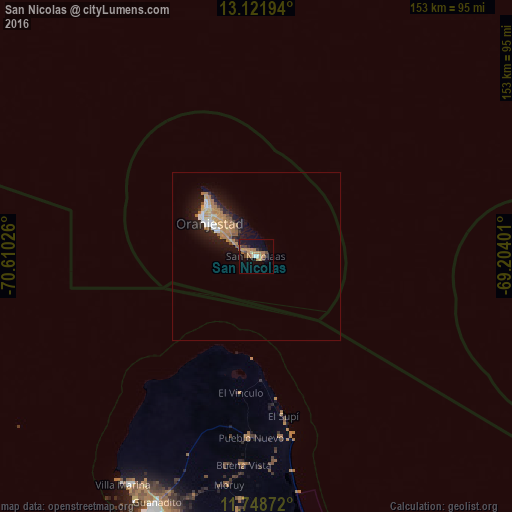
Analysis of San Nicolas night lights 2016
Square area 10x10 km:
 0.21%
0.21%90-99
1.45%80-89
1.03%70-79
6.4%60-69
7.44%50-59
0.83%40-49
2.48%30-39
2.69%20-29
2.27%10-19
16.12%0-9
59.09%Square area 50x50 km:
0.39%90-99
0.46%80-89
0.42%70-79
0.94%60-69
1.69%50-59
0.38%40-49
0.37%30-39
0.3%20-29
1.04%10-19
4.49%0-9
89.5%Clear (daylight) street map image can be seen on geolist.org.
Map coordinates:
13° 7' 19" North, 70° 36' 36.9" West
12° 26' 10.5" North, 69° 54' 25.7" West
11° 44' 55.4" North, 69° 12' 14.4" West
Some cities around San Nicolas sort by population:
• Punto Fijo, VE
88.7 km =55.1 mi,  200°
200°
• Punta Cardón, VE
92.8 km =57.7 mi, 201°
• Oranjestad
16.3 km =10.1 mi,  306°
306°
• Tanki Leendert
16.8 km =10.4 mi, 313°
• Santa Cruz
11.4 km =7.1 mi,  315°
315°
• Paradera
15.4 km =9.6 mi, 315°
• Savaneta
3.7 km =2.3 mi,  294°
294°
• Sint Michiel Liber, CW
105.3 km =65.4 mi,  107°
107°
3577089 (p: 15,200)
Sources (retrieved 2019-11-25):
» Earth at Night: Flat Maps 2012, 2016