San Ramón night lights from space
Night Light of San Ramón (Alajuela) from space (Costa Rica) Src. Average luminocity for 10x10km area is 37.2045% and for 50x50km: 13.6267%.
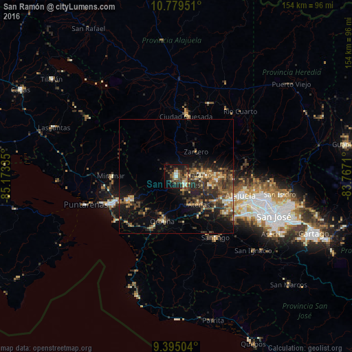
Analysis of San Ramón night lights 2016
Square area 10x10 km:
 4.13%
4.13%90-99
5.37%80-89
3.51%70-79
3.1%60-69
5.37%50-59
7.02%40-49
13.02%30-39
6.4%20-29
11.57%10-19
24.17%0-9
16.32%Square area 50x50 km:
0.52%90-99
1.32%80-89
1.58%70-79
1.68%60-69
2.21%50-59
2.62%40-49
3.5%30-39
3.59%20-29
5.08%10-19
8.9%0-9
68.99%Clear (daylight) street map image can be seen on geolist.org.
Map coordinates:
10° 46' 46.2" North, 85° 10' 24.1" West
10° 5' 16.9" North, 84° 28' 12.8" West
9° 23' 42.1" North, 83° 46' 1.6" West
Some cities around San Ramón sort by population:
• Quesada
26.6 km =16.5 mi,  10°
10°
• Esparza
23.7 km =14.7 mi,  243°
243°
• Desamparados
16.1 km =10 mi,  194°
194°
• Naranjo
10.1 km =6.3 mi,  83°
83°
• Río Segundo
27 km =16.8 mi,  50°
50°
• San Juan
16.9 km =10.5 mi, 84°
• Atenas
16.1 km =10 mi,  141°
141°
• Orotina
20.4 km =12.7 mi,  196°
196°
3621644 (p: 10,765)
Sources (retrieved 2019-11-25):
» Earth at Night: Flat Maps 2012, 2016