San Juan night lights from space
Night Light of San Juan (Alajuela) from space (Costa Rica) Src. Average luminocity for 10x10km area is 43.5248% and for 50x50km: 22.9029%.
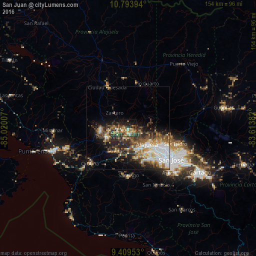
Analysis of San Juan night lights 2016
Square area 10x10 km:
 1.03%
1.03%90-99
6.4%80-89
5.79%70-79
5.58%60-69
12.19%50-59
9.71%40-49
10.54%30-39
10.74%20-29
8.68%10-19
21.69%0-9
7.64%Square area 50x50 km:
4.38%90-99
3.88%80-89
2.58%70-79
2.26%60-69
3.58%50-59
3.72%40-49
4.07%30-39
4.06%20-29
5.88%10-19
8.24%0-9
57.35%Clear (daylight) street map image can be seen on geolist.org.
Map coordinates:
10° 47' 38.2" North, 85° 1' 12.3" West
10° 6' 8.9" North, 84° 19' 1" West
9° 24' 34.3" North, 83° 36' 49.8" West
Some cities around San Juan sort by population:
• Alajuela
15 km =9.3 mi,  129°
129°
• Naranjo
6.7 km =4.2 mi,  266°
266°
• San Antonio
19.7 km =12.2 mi, 132°
• San Ramón
16.9 km =10.5 mi,  264°
264°
• Río Segundo
16 km =9.9 mi,  14°
14°
• Atenas
15.7 km =9.8 mi,  205°
205°
• Llorente
21.2 km =13.2 mi,  123°
123°
• Santo Domingo
18.2 km =11.3 mi,  103°
103°
3621817 (p: 7,729)
Sources (retrieved 2019-11-25):
» Earth at Night: Flat Maps 2012, 2016