Naranjo night lights from space
Night Light of Naranjo (Alajuela) from space (Costa Rica) Src. Average luminocity for 10x10km area is 44.4587% and for 50x50km: 18.3476%.
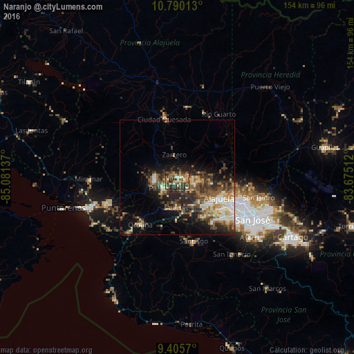
Analysis of Naranjo night lights 2016
Square area 10x10 km:
 1.24%
1.24%90-99
3.72%80-89
7.85%70-79
6.82%60-69
10.95%50-59
8.88%40-49
6.82%30-39
16.94%20-29
16.94%10-19
18.6%0-9
1.24%Square area 50x50 km:
1.84%90-99
2.81%80-89
2.29%70-79
2.23%60-69
2.82%50-59
3.29%40-49
3.91%30-39
4.03%20-29
5.84%10-19
8.06%0-9
62.88%Clear (daylight) street map image can be seen on geolist.org.
Map coordinates:
10° 47' 24.5" North, 85° 4' 52.9" West
10° 5' 55.2" North, 84° 22' 41.7" West
9° 24' 20.5" North, 83° 40' 30.4" West
Some cities around Naranjo sort by population:
• Alajuela
20.4 km =12.7 mi,  116°
116°
• Desamparados
21.9 km =13.6 mi,  219°
219°
• San Antonio
24.9 km =15.5 mi, 121°
• San Ramón
10.1 km =6.3 mi,  263°
263°
• Río Segundo
19.2 km =11.9 mi,  34°
34°
• San Juan
6.7 km =4.2 mi,  86°
86°
• Atenas
13.8 km =8.6 mi,  180°
180°
• Santo Domingo
24.7 km =15.3 mi,  98°
98°
3622751 (p: 11,853)
Sources (retrieved 2019-11-25):
» Earth at Night: Flat Maps 2012, 2016