Pocora night lights from space
Night Light of Pocora (Limón) from space (Costa Rica) Src. Average luminocity for 10x10km area is 5.5331% and for 50x50km: 3.8267%.
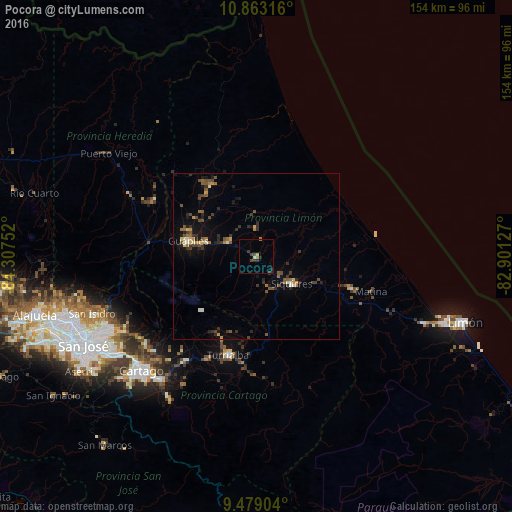
Analysis of Pocora night lights 2016
Square area 10x10 km:
 0%
0%90-99
0%80-89
1.45%70-79
0.21%60-69
1.24%50-59
0%40-49
1.45%30-39
3.31%20-29
1.65%10-19
0.21%0-9
90.5%Square area 50x50 km:
0.05%90-99
0.35%80-89
0.35%70-79
0.45%60-69
0.55%50-59
0.7%40-49
0.93%30-39
1.13%20-29
1.04%10-19
1.69%0-9
92.78%Clear (daylight) street map image can be seen on geolist.org.
Map coordinates:
10° 51' 47.4" North, 84° 18' 27.1" West
10° 10' 18.7" North, 83° 36' 15.8" West
9° 28' 44.5" North, 82° 54' 4.6" West
Some cities around Pocora sort by population:
• Paraíso
46.8 km =29.1 mi,  217°
217°
• Turrialba
30.9 km =19.2 mi,  196°
196°
• Ipís
50.2 km =31.2 mi,  243°
243°
• Cartago
48.6 km =30.2 mi,  225°
225°
• Guápiles
20.4 km =12.7 mi,  284°
284°
• Siquirres
13.5 km =8.4 mi,  127°
127°
• Guácimo
10.2 km =6.3 mi,  296°
296°
• Cot
42.6 km =26.5 mi, 223°
3622325 (p: 5,248)
Sources (retrieved 2019-11-25):
» Earth at Night: Flat Maps 2012, 2016