Cot night lights from space
Night Light of Cot (Cartago) from space (Costa Rica) Src. Average luminocity for 10x10km area is 37.0475% and for 50x50km: 17.643%.
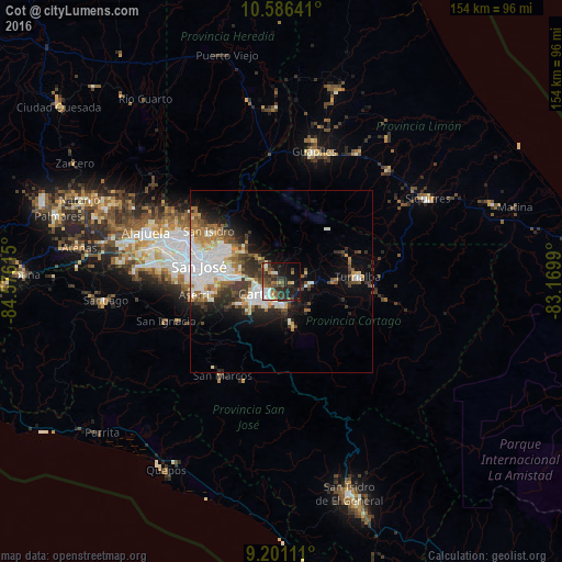
Analysis of Cot night lights 2016
Square area 10x10 km:
 3.93%
3.93%90-99
5.79%80-89
3.51%70-79
2.48%60-69
3.93%50-59
5.79%40-49
11.16%30-39
10.95%20-29
15.7%10-19
25.83%0-9
10.95%Square area 50x50 km:
4.4%90-99
3.6%80-89
1.52%70-79
1.46%60-69
2.3%50-59
1.89%40-49
2.62%30-39
3.01%20-29
3.82%10-19
6.73%0-9
68.65%Clear (daylight) street map image can be seen on geolist.org.
Map coordinates:
10° 35' 11.1" North, 84° 34' 34.1" West
9° 53' 40.2" North, 83° 52' 22.9" West
9° 12' 4" North, 83° 10' 11.6" West
Some cities around Cot sort by population:
• Paraíso
6.3 km =3.9 mi,  172°
172°
• Curridabat
17.7 km =11 mi,  276°
276°
• Ipís
17.4 km =10.8 mi,  297°
297°
• Cartago
6.1 km =3.8 mi,  236°
236°
• San Diego
14.2 km =8.8 mi,  272°
272°
• Concepción
14.6 km =9.1 mi,  287°
287°
• Granadilla
16.4 km =10.2 mi, 285°
• Tres Ríos
12.6 km =7.8 mi, 276°
3624057 (p: 6,784)
Sources (retrieved 2019-11-25):
» Earth at Night: Flat Maps 2012, 2016