Yondó night lights from space
Night Light of Yondó (Antioquia) from space (Colombia) Src. Average luminocity for 10x10km area is 15.5606% and for 50x50km: 5.5498%.
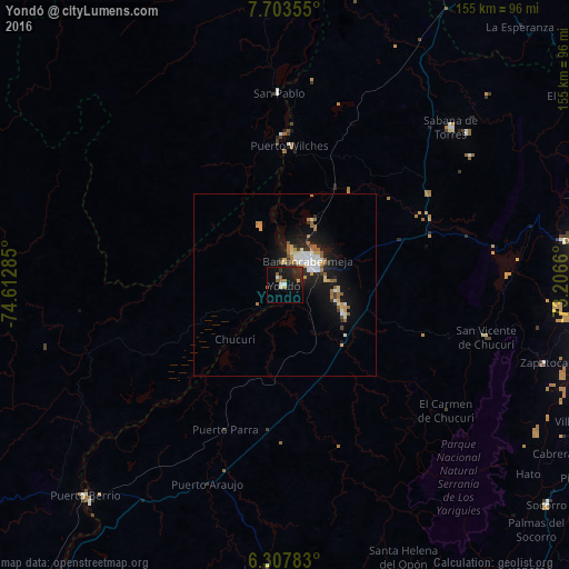
Analysis of Yondó night lights 2016
Square area 10x10 km:
 2.16%
2.16%90-99
0.65%80-89
0.65%70-79
1.73%60-69
2.16%50-59
3.9%40-49
0%30-39
0%20-29
10.17%10-19
19.05%0-9
59.52%Square area 50x50 km:
0.88%90-99
0.92%80-89
0.38%70-79
0.67%60-69
0.74%50-59
1.06%40-49
0.14%30-39
0.49%20-29
1.38%10-19
5.19%0-9
88.13%Clear (daylight) street map image can be seen on geolist.org.
Map coordinates:
7° 42' 12.8" North, 74° 36' 46.3" West
7° 0' 22.4" North, 73° 54' 35" West
6° 18' 28.2" North, 73° 12' 23.8" West
Some cities around Yondó sort by population:
• Barrancabermeja
8.9 km =5.5 mi,  42°
42°
• Puerto Berrío
79 km =49.1 mi,  223°
223°
• Puerto Wilches
38.1 km =23.7 mi,  2°
2°
• Sabana de Torres
62.6 km =38.9 mi,  46°
46°
• Cimitarra
77.1 km =47.9 mi,  183°
183°
• San Vicente de Chucurí
56.9 km =35.4 mi,  104°
104°
• Lebrija
77.3 km =48 mi,  81°
81°
• Zapatoca
74 km =46 mi,  106°
106°
3665691 (p: 7,516)
Sources (retrieved 2019-11-25):
» Earth at Night: Flat Maps 2012, 2016