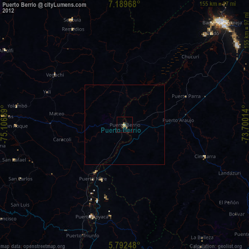
Puerto Berrío night lights from space
Night Light of Puerto Berrío (Antioquia) from space (Colombia) Src. Average luminocity for 10x10km area is 9.0974% and for 50x50km: 0.4011%.
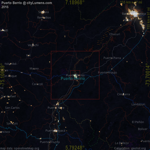
Analysis of Puerto Berrío night lights 2016
Square area 10x10 km:
 0.87%
0.87%90-99
2.16%80-89
1.3%70-79
0.87%60-69
0.65%50-59
2.81%40-49
0.22%30-39
1.52%20-29
0.87%10-19
0%0-9
88.74%Square area 50x50 km:
0.03%90-99
0.09%80-89
0.05%70-79
0.03%60-69
0.03%50-59
0.11%40-49
0.02%30-39
0.09%20-29
0.04%10-19
0.03%0-9
99.48%Clear (daylight) street map image can be seen on geolist.org.
Map coordinates:
7° 11' 22.8" North, 75° 6' 23" West
6° 29' 29.6" North, 74° 24' 11.7" West
5° 47' 32.9" North, 73° 42' 0.5" West
Some cities around Puerto Berrío sort by population:
• Segovia
73.1 km =45.4 mi,  333°
333°
• Cimitarra
53.9 km =33.5 mi,  111°
111°
• Vegachí
52.6 km =32.7 mi,  304°
304°
• San Carlos
73.4 km =45.6 mi,  242°
242°
• San Rafael
72.2 km =44.9 mi,  252°
252°
• Remedios
67.8 km =42.1 mi, 331°
• Yolombó
68.2 km =42.4 mi,  280°
280°
• San Roque
68.1 km =42.3 mi,  269°
269°
3671540 (p: 33,983)
Sources (retrieved 2019-11-25):
» Earth at Night: Flat Maps 2012, 2016