Puerto Wilches night lights from space
Night Light of Puerto Wilches (Santander) from space (Colombia) Src. Average luminocity for 10x10km area is 7.2186% and for 50x50km: 1.0493%.
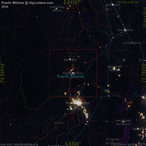
Analysis of Puerto Wilches night lights 2016
Square area 10x10 km:
 0.43%
0.43%90-99
1.3%80-89
0%70-79
0%60-69
2.38%50-59
1.08%40-49
1.08%30-39
3.25%20-29
2.38%10-19
1.95%0-9
86.15%Square area 50x50 km:
0.05%90-99
0.12%80-89
0%70-79
0.2%60-69
0.32%50-59
0.2%40-49
0.08%30-39
0.23%20-29
0.2%10-19
0.47%0-9
98.15%Clear (daylight) street map image can be seen on geolist.org.
Map coordinates:
8° 2' 42.3" North, 74° 35' 56.9" West
7° 20' 53.8" North, 73° 53' 45.6" West
6° 39' 1.4" North, 73° 11' 34.4" West
Some cities around Puerto Wilches sort by population:
• Barrancabermeja
31.8 km =19.8 mi,  171°
171°
• Sabana de Torres
44.4 km =27.6 mi,  83°
83°
• San Vicente de Chucurí
74.7 km =46.4 mi,  134°
134°
• San Alberto
72 km =44.7 mi,  50°
50°
• Santa Rosa del Sur
70.7 km =43.9 mi,  345°
345°
• Yondó
38.1 km =23.7 mi,  182°
182°
• Simití
68 km =42.3 mi,  355°
355°
• El Playón
77.6 km =48.2 mi, 79°
3671287 (p: 13,705)
Sources (retrieved 2019-11-25):
» Earth at Night: Flat Maps 2012, 2016