Trujillo night lights from space
Night Light of Trujillo (Valle del Cauca) from space (Colombia) Src. Average luminocity for 10x10km area is 2.1494% and for 50x50km: 4.9691%.
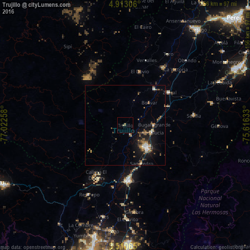
Analysis of Trujillo night lights 2016
Square area 10x10 km:
 0%
0%90-99
0%80-89
0.87%70-79
0%60-69
0.87%50-59
0%40-49
0.87%30-39
0%20-29
0%10-19
0%0-9
97.4%Square area 50x50 km:
0.45%90-99
0.47%80-89
0.45%70-79
0.66%60-69
0.82%50-59
0.92%40-49
0.82%30-39
0.91%20-29
0.78%10-19
4.19%0-9
89.53%Clear (daylight) street map image can be seen on geolist.org.
Map coordinates:
4° 54' 47" North, 77° 1' 21.3" West
4° 12' 43.8" North, 76° 19' 10" West
3° 30' 38.3" North, 75° 36' 58.8" West
Some cities around Trujillo sort by population:
• Tuluá
19.8 km =12.3 mi,  135°
135°
• Zarzal
34.2 km =21.3 mi,  53°
53°
• Roldanillo
28.8 km =17.9 mi,  39°
39°
• Andalucía
17.6 km =10.9 mi,  105°
105°
• Bugalagrande
18.2 km =11.3 mi,  90°
90°
• Riofrío
7 km =4.3 mi,  150°
150°
• El Dovio
34.2 km =21.3 mi,  15°
15°
• San Pedro
26.2 km =16.3 mi,  157°
157°
3666680 (p: 5,874)
Sources (retrieved 2019-11-25):
» Earth at Night: Flat Maps 2012, 2016