Andalucía night lights from space
Night Light of Andalucía (Valle del Cauca) from space (Colombia) Src. Average luminocity for 10x10km area is 21.9416% and for 50x50km: 5.3415%.
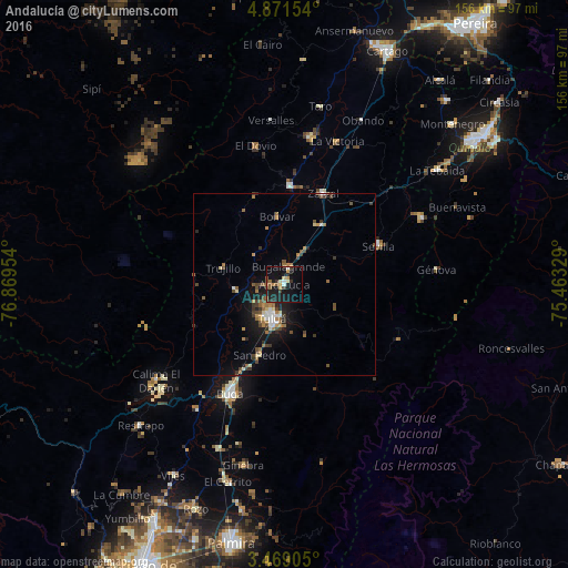
Analysis of Andalucía night lights 2016
Square area 10x10 km:
 1.08%
1.08%90-99
1.95%80-89
2.38%70-79
3.25%60-69
1.3%50-59
5.84%40-49
2.6%30-39
4.33%20-29
4.55%10-19
31.6%0-9
41.13%Square area 50x50 km:
0.42%90-99
0.49%80-89
0.48%70-79
0.58%60-69
0.93%50-59
0.92%40-49
1.08%30-39
1.14%20-29
0.8%10-19
4.44%0-9
88.71%Clear (daylight) street map image can be seen on geolist.org.
Map coordinates:
4° 52' 17.5" North, 76° 52' 10.3" West
4° 10' 14.2" North, 76° 9' 59.1" West
3° 28' 8.6" North, 75° 27' 47.8" West
Some cities around Andalucía sort by population:
• Tuluá
10.1 km =6.3 mi,  198°
198°
• Sevilla
28.1 km =17.5 mi,  68°
68°
• Zarzal
27 km =16.8 mi,  22°
22°
• Roldanillo
26.9 km =16.7 mi,  2°
2°
• Bugalagrande
4.8 km =3 mi,  14°
14°
• Riofrío
13.6 km =8.5 mi,  263°
263°
• Trujillo
17.6 km =10.9 mi,  285°
285°
• San Pedro
20.8 km =12.9 mi, 199°
3689905 (p: 17,432)
Sources (retrieved 2019-11-25):
» Earth at Night: Flat Maps 2012, 2016