Tuluá night lights from space
Night Light of Tuluá (Valle del Cauca) from space (Colombia) Src. Average luminocity for 10x10km area is 46.8831% and for 50x50km: 6.2949%.
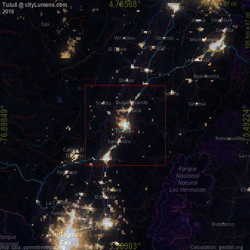
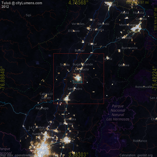
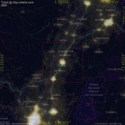
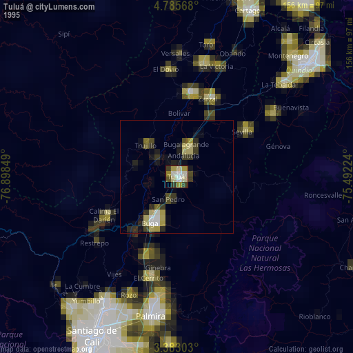
Analysis of Tuluá night lights 2016
Square area 10x10 km:
 8.44%
8.44%90-99
7.58%80-89
4.76%70-79
6.71%60-69
8.23%50-59
6.49%40-49
6.93%30-39
9.31%20-29
8.66%10-19
31.82%0-9
1.08%Square area 50x50 km:
0.64%90-99
0.66%80-89
0.65%70-79
0.65%60-69
1.05%50-59
0.99%40-49
1.04%30-39
1.15%20-29
0.87%10-19
6.18%0-9
86.13%Clear (daylight) street map image can be seen on geolist.org.
Map coordinates:
4° 47' 8.4" North, 76° 53' 54.6" West
4° 5' 4.8" North, 76° 11' 43.3" West
3° 22' 58.9" North, 75° 29' 32.1" West
Some cities around Tuluá sort by population:
• Guadalajara de Buga
23.4 km =14.5 mi,  209°
209°
• Sevilla
35.5 km =22.1 mi,  55°
55°
• Andalucía
10.1 km =6.3 mi,  18°
18°
• Bugalagrande
14.8 km =9.2 mi, 17°
• Riofrío
13.1 km =8.1 mi,  307°
307°
• Yotoco
32.5 km =20.2 mi,  219°
219°
• Trujillo
19.8 km =12.3 mi,  315°
315°
• San Pedro
10.7 km =6.6 mi,  200°
200°
3666645 (p: 165,501)
Sources (retrieved 2019-11-25):
» NASA, Earths city lights 1995
» NASA city lights 2003
» Earth at Night: Flat Maps 2012, 2016