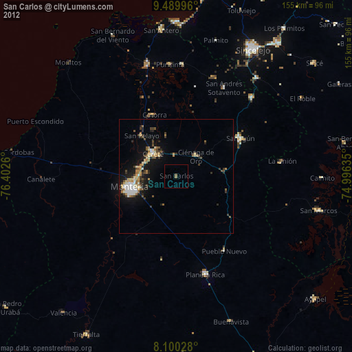
San Carlos night lights from space
Night Light of San Carlos (Córdoba) from space (Colombia) Src. Average luminocity for 10x10km area is 1.1302% and for 50x50km: 5.1724%.
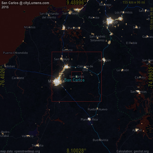
Analysis of San Carlos night lights 2016
Square area 10x10 km:
 0%
0%90-99
0%80-89
0%70-79
0%60-69
0.83%50-59
0%40-49
0%30-39
0.83%20-29
0%10-19
0%0-9
98.35%Square area 50x50 km:
0.85%90-99
0.77%80-89
0.31%70-79
0.45%60-69
0.89%50-59
0.38%40-49
0.65%30-39
1.25%20-29
1.28%10-19
4.74%0-9
88.43%Clear (daylight) street map image can be seen on geolist.org.
Map coordinates:
9° 29' 23.9" North, 76° 24' 9.4" West
8° 47' 44.8" North, 75° 41' 58.1" West
8° 6' 1" North, 74° 59' 46.9" West
Some cities around San Carlos sort by population:
• Montería
20.7 km =12.9 mi,  255°
255°
• Sahagún
32.8 km =20.4 mi,  59°
59°
• Cereté
14.1 km =8.8 mi,  314°
314°
• Planeta Rica
44.5 km =27.7 mi,  163°
163°
• Chinú
47.8 km =29.7 mi,  43°
43°
• Ciénaga de Oro
12.3 km =7.6 mi, 44°
• San Pelayo
23.5 km =14.6 mi,  320°
320°
• Buenavista
43.7 km =27.2 mi, 310°
3669997 (p: 24,615)
Sources (retrieved 2019-11-25):
» Earth at Night: Flat Maps 2012, 2016