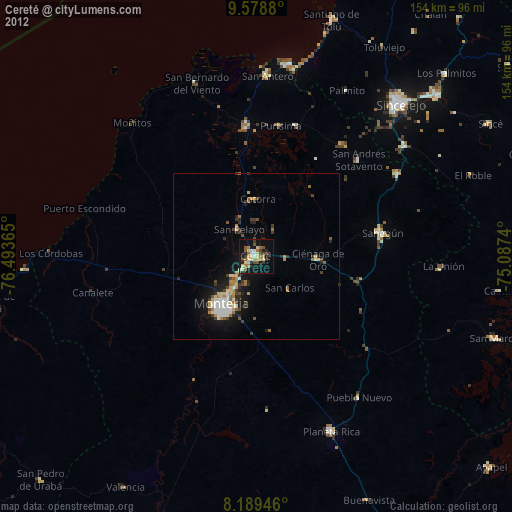
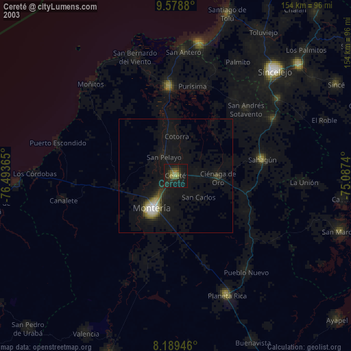
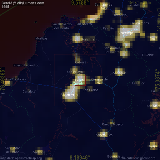
Cereté night lights from space
Night Light of Cereté (Córdoba) from space (Colombia) Src. Average luminocity for 10x10km area is 25.9567% and for 50x50km: 5.3366%.
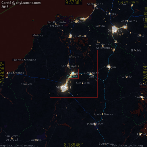
Analysis of Cereté night lights 2016
Square area 10x10 km:
 3.03%
3.03%90-99
3.9%80-89
1.73%70-79
2.81%60-69
6.93%50-59
1.73%40-49
5.41%30-39
1.73%20-29
6.06%10-19
26.84%0-9
39.83%Square area 50x50 km:
0.86%90-99
0.77%80-89
0.31%70-79
0.46%60-69
0.9%50-59
0.38%40-49
0.67%30-39
1.31%20-29
1.36%10-19
5.05%0-9
87.93%Clear (daylight) street map image can be seen on geolist.org.
Map coordinates:
9° 34' 43.7" North, 76° 29' 37.1" West
8° 53' 5.2" North, 75° 47' 25.9" West
8° 11' 22.1" North, 75° 5' 14.6" West
Some cities around Cereté sort by population:
• Montería
18.2 km =11.3 mi,  213°
213°
• Sahagún
38.8 km =24.1 mi,  79°
79°
• Lorica
39.2 km =24.4 mi,  356°
356°
• San Carlos
14.1 km =8.8 mi,  134°
134°
• Ciénaga de Oro
18.7 km =11.6 mi,  93°
93°
• Purísima de la Concepción
39.8 km =24.7 mi,  10°
10°
• San Pelayo
9.6 km =6 mi,  328°
328°
• Buenavista
29.7 km =18.5 mi,  308°
308°
3686922 (p: 55,513)
Sources (retrieved 2019-11-25):
» NASA, Earths city lights 1995
» NASA city lights 2003
» Earth at Night: Flat Maps 2012, 2016