Planeta Rica night lights from space
Night Light of Planeta Rica (Córdoba) from space (Colombia) Src. Average luminocity for 10x10km area is 6.4091% and for 50x50km: 0.374%.
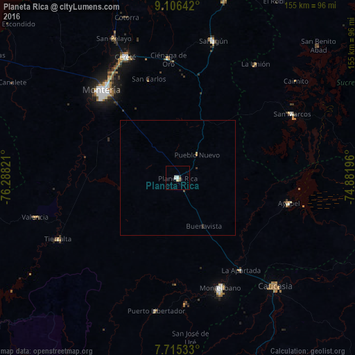
Analysis of Planeta Rica night lights 2016
Square area 10x10 km:
 0.83%
0.83%90-99
2.48%80-89
0.83%70-79
0.41%60-69
0.41%50-59
0%40-49
1.03%30-39
0.62%20-29
0%10-19
0.83%0-9
92.56%Square area 50x50 km:
0.03%90-99
0.1%80-89
0.07%70-79
0.05%60-69
0.02%50-59
0%40-49
0.08%30-39
0.09%20-29
0.03%10-19
0.03%0-9
99.49%Clear (daylight) street map image can be seen on geolist.org.
Map coordinates:
9° 6' 23.1" North, 76° 17' 17.6" West
8° 24' 41.4" North, 75° 35' 6.3" West
7° 42' 55.2" North, 74° 52' 55.1" West
Some cities around Planeta Rica sort by population:
• Montería
49.6 km =30.8 mi,  318°
318°
• Montelíbano
51.4 km =31.9 mi,  159°
159°
• Cereté
57.3 km =35.6 mi,  336°
336°
• San Marcos
57.3 km =35.6 mi,  61°
61°
• San Carlos
44.5 km =27.7 mi, 343°
• Ayapel
50.2 km =31.2 mi,  102°
102°
• Ciénaga de Oro
51.6 km =32.1 mi,  355°
355°
• Moñitos
54.2 km =33.7 mi,  250°
250°
3672068 (p: 37,297)
Sources (retrieved 2019-11-25):
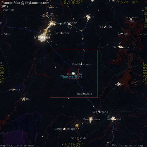
» Earth at Night: Flat Maps 2012, 2016