San Pelayo night lights from space
Night Light of San Pelayo (Córdoba) from space (Colombia) Src. Average luminocity for 10x10km area is 7.1775% and for 50x50km: 4.3381%.
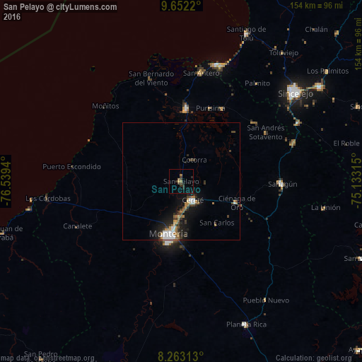
Analysis of San Pelayo night lights 2016
Square area 10x10 km:
 0%
0%90-99
0%80-89
0.65%70-79
0.22%60-69
1.73%50-59
0.87%40-49
2.16%30-39
3.9%20-29
2.16%10-19
1.3%0-9
87.01%Square area 50x50 km:
0.71%90-99
0.58%80-89
0.22%70-79
0.43%60-69
0.82%50-59
0.3%40-49
0.7%30-39
1.07%20-29
1.01%10-19
3.72%0-9
90.44%Clear (daylight) street map image can be seen on geolist.org.
Map coordinates:
9° 39' 7.9" North, 76° 32' 21.8" West
8° 57' 30" North, 75° 50' 10.6" West
8° 15' 47.3" North, 75° 7' 59.3" West
Some cities around San Pelayo sort by population:
• Montería
23.9 km =14.9 mi,  191°
191°
• Cereté
9.6 km =6 mi,  148°
148°
• Lorica
31 km =19.3 mi,  4°
4°
• San Carlos
23.5 km =14.6 mi,  140°
140°
• Ciénaga de Oro
25.5 km =15.8 mi,  111°
111°
• Purísima de la Concepción
33.4 km =20.8 mi,  22°
22°
• Momil
35.8 km =22.2 mi,  29°
29°
• Buenavista
20.9 km =13 mi,  299°
299°
3669084 (p: 5,637)
Sources (retrieved 2019-11-25):
» Earth at Night: Flat Maps 2012, 2016