San Benito Abad night lights from space
Night Light of San Benito Abad (Sucre) from space (Colombia) Src. Average luminocity for 10x10km area is 1.8506% and for 50x50km: 0.1511%.
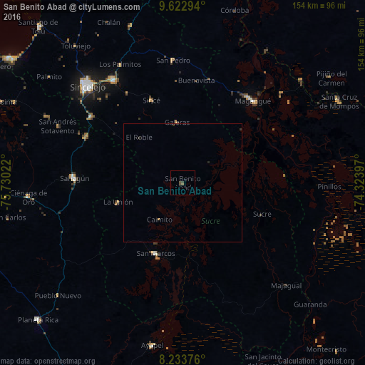
Analysis of San Benito Abad night lights 2016
Square area 10x10 km:
 0%
0%90-99
0%80-89
0%70-79
0%60-69
0.22%50-59
0.65%40-49
1.95%30-39
0.65%20-29
0%10-19
0%0-9
96.54%Square area 50x50 km:
0%90-99
0%80-89
0%70-79
0.03%60-69
0.01%50-59
0.03%40-49
0.08%30-39
0.13%20-29
0.03%10-19
0%0-9
99.69%Clear (daylight) street map image can be seen on geolist.org.
Map coordinates:
9° 37' 22.6" North, 75° 43' 48.8" West
8° 55' 44.4" North, 75° 1' 37.5" West
8° 14' 1.5" North, 74° 19' 26.3" West
Some cities around San Benito Abad sort by population:
• Magangué
45.9 km =28.5 mi,  40°
40°
• Sahagún
45.7 km =28.4 mi,  272°
272°
• San Marcos
31.9 km =19.8 mi,  200°
200°
• San Luis de Sincé
37.4 km =23.2 mi,  339°
339°
• Sucre
36.1 km =22.4 mi,  111°
111°
• Chinú
45.2 km =28.1 mi,  295°
295°
• Galeras
25.9 km =16.1 mi,  354°
354°
• San Juan de Betulia
44.9 km =27.9 mi,  328°
328°
3670038 (p: 18,181)
Sources (retrieved 2019-11-25):
» Earth at Night: Flat Maps 2012, 2016