Rioblanco night lights from space
Night Light of Rioblanco (Tolima) from space (Colombia) Src. Average luminocity for 10x10km area is 0.3983% and for 50x50km: 0.3677%.
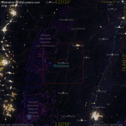
Analysis of Rioblanco night lights 2016
Square area 10x10 km:
 0%
0%90-99
0%80-89
0%70-79
0%60-69
0%50-59
0%40-49
0.87%30-39
0%20-29
0%10-19
0%0-9
99.13%Square area 50x50 km:
0.03%90-99
0.01%80-89
0.03%70-79
0.07%60-69
0.1%50-59
0.18%40-49
0.03%30-39
0%20-29
0.05%10-19
0.09%0-9
99.41%Clear (daylight) street map image can be seen on geolist.org.
Map coordinates:
4° 13' 52.5" North, 76° 20' 54.2" West
3° 31' 47" North, 75° 38' 42.9" West
2° 49' 39.7" North, 74° 56' 31.7" West
Some cities around Rioblanco sort by population:
• Chaparral
28 km =17.4 mi,  39°
39°
• Natagaima
62 km =38.5 mi,  80°
80°
• Gaitania
46.3 km =28.8 mi,  204°
204°
• Planadas
37 km =23 mi,  179°
179°
• Aipe
56.8 km =35.3 mi,  127°
127°
• Ortega
65.2 km =40.5 mi,  46°
46°
• Playarrica
64.2 km =39.9 mi,  23°
23°
• San Antonio
46.5 km =28.9 mi, 23°
3670764 (p: 6,210)
Sources (retrieved 2019-11-25):
» Earth at Night: Flat Maps 2012, 2016