Purísima de la Concepción night lights from space
Night Light of Purísima de la Concepción (Córdoba) from space (Colombia) Src. Average luminocity for 10x10km area is 2.9177% and for 50x50km: 2.2457%.
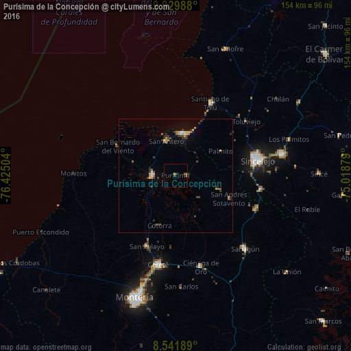
Analysis of Purísima de la Concepción night lights 2016
Square area 10x10 km:
 0%
0%90-99
0%80-89
0%70-79
1.3%60-69
0.43%50-59
0.22%40-49
0.65%30-39
1.73%20-29
0.22%10-19
0.65%0-9
94.81%Square area 50x50 km:
0.12%90-99
0.12%80-89
0.16%70-79
0.58%60-69
0.39%50-59
0.17%40-49
0.42%30-39
0.76%20-29
0.53%10-19
0.42%0-9
96.33%Clear (daylight) street map image can be seen on geolist.org.
Map coordinates:
9° 55' 47.6" North, 76° 25' 30.1" West
9° 14' 11.7" North, 75° 43' 18.9" West
8° 32' 30.8" North, 75° 1' 7.6" West
Some cities around Purísima de la Concepción sort by population:
• Sincelejo
36.4 km =22.6 mi,  77°
77°
• Lorica
10.1 km =6.3 mi,  269°
269°
• Santiago de Tolú
35.5 km =22.1 mi,  25°
25°
• San Antero
15.8 km =9.8 mi,  345°
345°
• San Bernardo del Viento
28.4 km =17.6 mi,  297°
297°
• Momil
5.2 km =3.2 mi,  88°
88°
• San Pelayo
33.4 km =20.8 mi,  202°
202°
• Palmito
22.4 km =13.9 mi,  61°
61°
3671203 (p: 7,043)
Sources (retrieved 2019-11-25):
» Earth at Night: Flat Maps 2012, 2016