Puerto Colombia night lights from space
Night Light of Puerto Colombia (Atlántico) from space (Colombia) Src. Average luminocity for 10x10km area is 31.368% and for 50x50km: 19.0355%.
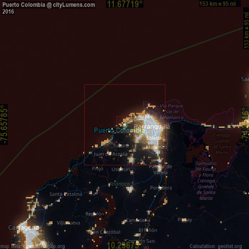
Analysis of Puerto Colombia night lights 2016
Square area 10x10 km:
 1.08%
1.08%90-99
1.08%80-89
2.38%70-79
9.52%60-69
11.04%50-59
1.73%40-49
4.11%30-39
7.36%20-29
11.47%10-19
24.46%0-9
25.76%Square area 50x50 km:
4.6%90-99
2.6%80-89
1.02%70-79
3.64%60-69
2.91%50-59
1.96%40-49
2.63%30-39
3.4%20-29
4.2%10-19
8.5%0-9
64.53%Clear (daylight) street map image can be seen on geolist.org.
Map coordinates:
11° 40' 37.9" North, 75° 39' 28.3" West
10° 59' 16" North, 74° 57' 17" West
10° 17' 48.3" North, 74° 15' 5.8" West
Some cities around Puerto Colombia sort by population:
• Barranquilla
19 km =11.8 mi,  96°
96°
• Soledad
22.1 km =13.7 mi,  110°
110°
• Malambo
24.4 km =15.2 mi,  125°
125°
• Baranoa
21.9 km =13.6 mi,  169°
169°
• Galapa
12.6 km =7.8 mi,  143°
143°
• Polonuevo
25.9 km =16.1 mi,  154°
154°
• Juan de Acosta
19.6 km =12.2 mi,  206°
206°
• Tubará
12.7 km =7.9 mi,  191°
191°
3671497 (p: 26,227)
Sources (retrieved 2019-11-25):
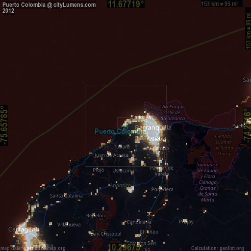
» Earth at Night: Flat Maps 2012, 2016