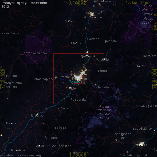
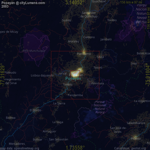
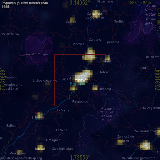
Popayán night lights from space
Night Light of Popayán (Cauca) from space (Colombia) Src. Average luminocity for 10x10km area is 54.2987% and for 50x50km: 5.6826%.
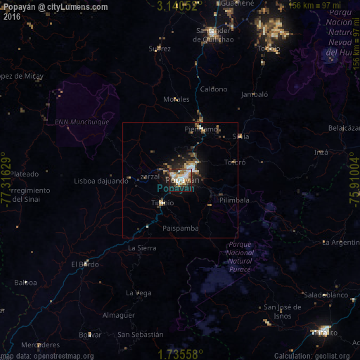
Analysis of Popayán night lights 2016
Square area 10x10 km:
 12.12%
90-99
12.77%80-89
6.49%70-79
6.71%60-69
10.82%50-59
2.16%40-49
4.98%30-39
10.39%20-29
8.87%10-19
22.29%0-9
2.38%Square area 50x50 km:
0.68%90-99
0.88%80-89
0.59%70-79
0.46%60-69
0.84%50-59
0.7%40-49
1.01%30-39
1.31%20-29
1.49%10-19
3.93%0-9
88.11%Clear (daylight) street map image can be seen on geolist.org.
Map coordinates:
3° 8' 25.9" North, 77° 18' 58.6" West
2° 26' 17.6" North, 76° 36' 47.4" West
1° 44' 8.1" North, 75° 54' 36.1" West
Some cities around Popayán sort by population:
• Piendamo
24.2 km =15 mi,  22°
22°
• Morales
35.2 km =21.9 mi,  357°
357°
• Patía
63.8 km =39.6 mi,  229°
229°
• El Bordo
54.4 km =33.8 mi, 228°
• Suárez
58.1 km =36.1 mi,  350°
350°
• Villa Rica
27.6 km =17.1 mi,  287°
287°
• Silvia
32.3 km =20.1 mi,  52°
52°
• El Tambo
22 km =13.7 mi,  273°
273°
3671916 (p: 258,653)
Sources (retrieved 2019-11-25):
» NASA, Earths city lights 1995
» NASA city lights 2003
» Earth at Night: Flat Maps 2012, 2016