Ovejas night lights from space
Night Light of Ovejas (Sucre) from space (Colombia) Src. Average luminocity for 10x10km area is 3.0022% and for 50x50km: 2.6116%.
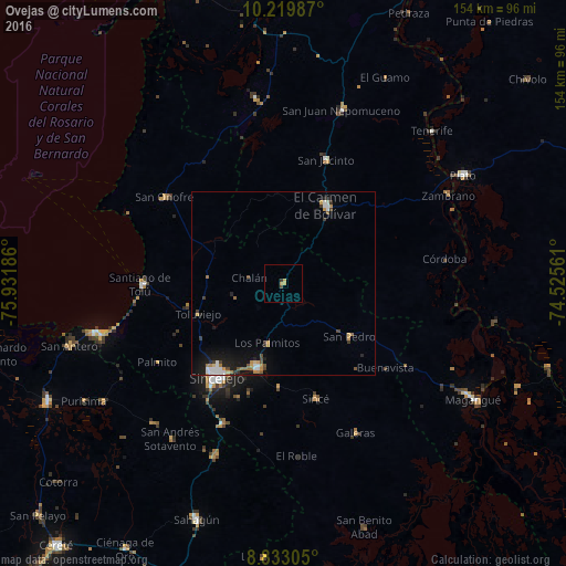
Analysis of Ovejas night lights 2016
Square area 10x10 km:
 0%
0%90-99
0%80-89
0.43%70-79
2.16%60-69
0%50-59
0%40-49
0.87%30-39
0.87%20-29
0%10-19
0%0-9
95.67%Square area 50x50 km:
0.39%90-99
0.36%80-89
0.14%70-79
0.48%60-69
0.44%50-59
0.25%40-49
0.33%30-39
0.45%20-29
0.33%10-19
1.95%0-9
94.89%Clear (daylight) street map image can be seen on geolist.org.
Map coordinates:
10° 13' 11.5" North, 75° 55' 54.7" West
9° 31' 37.8" North, 75° 13' 43.4" West
8° 49' 59" North, 74° 31' 32.2" West
Some cities around Ovejas sort by population:
• Sincelejo
30.9 km =19.2 mi,  216°
216°
• El Carmen de Bolívar
24.3 km =15.1 mi,  29°
29°
• Corozal
24.3 km =15.1 mi,  196°
196°
• San Luis de Sincé
32.8 km =20.4 mi,  164°
164°
• Los Palmitos
17 km =10.6 mi,  194°
194°
• San Pedro
23.2 km =14.4 mi,  129°
129°
• San Juan de Betulia
28.2 km =17.5 mi,  182°
182°
• Tolú Viejo
24.5 km =15.2 mi,  249°
249°
3673455 (p: 13,284)
Sources (retrieved 2019-11-25):
» Earth at Night: Flat Maps 2012, 2016