Neiva night lights from space
Night Light of Neiva (Huila) from space (Colombia) Src. Average luminocity for 10x10km area is 63.3117% and for 50x50km: 5.1623%.
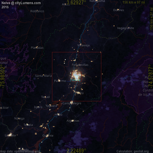
Analysis of Neiva night lights 2016
Square area 10x10 km:
 16.23%
90-99
19.26%80-89
8.66%70-79
6.93%60-69
4.76%50-59
5.41%40-49
4.98%30-39
6.28%20-29
16.02%10-19
11.47%0-9
0%Square area 50x50 km:
0.69%90-99
0.97%80-89
0.56%70-79
0.6%60-69
0.54%50-59
0.47%40-49
0.69%30-39
0.92%20-29
1.25%10-19
3.73%0-9
89.58%Clear (daylight) street map image can be seen on geolist.org.
Map coordinates:
3° 37' 45.4" North, 75° 59' 6.1" West
2° 55' 38.3" North, 75° 16' 54.8" West
2° 13' 29.6" North, 74° 34' 43.6" West
Some cities around Neiva sort by population:
• Campoalegre
27.3 km =17 mi,  189°
189°
• Algeciras
45 km =28 mi, 185°
• Palermo
17.7 km =11 mi,  257°
257°
• Planadas
50.3 km =31.3 mi,  306°
306°
• Rivera
16.9 km =10.5 mi,  170°
170°
• Aipe
33.2 km =20.6 mi,  8°
8°
• Santa Isabel
57.6 km =35.8 mi,  35°
35°
• Yaguará
39.3 km =24.4 mi,  221°
221°
3673899 (p: 352,855)
Sources (retrieved 2019-11-25):
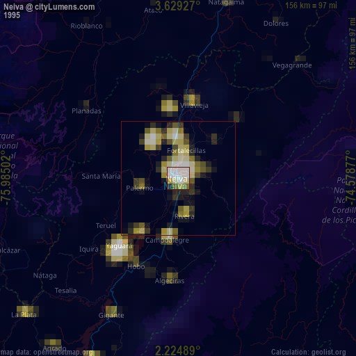
» NASA, Earths city lights 1995
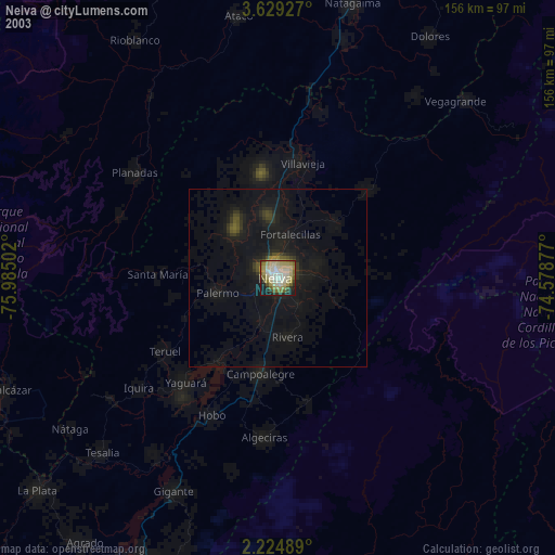
» NASA city lights 2003
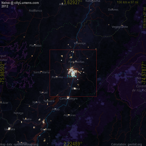
» Earth at Night: Flat Maps 2012, 2016