Rivera night lights from space
Night Light of Rivera (Huila) from space (Colombia) Src. Average luminocity for 10x10km area is 10.1061% and for 50x50km: 5.1621%.
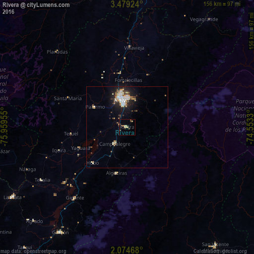
Analysis of Rivera night lights 2016
Square area 10x10 km:
 0%
0%90-99
0.87%80-89
2.81%70-79
1.95%60-69
0.87%50-59
0.87%40-49
3.46%30-39
1.3%20-29
2.16%10-19
0%0-9
85.71%Square area 50x50 km:
0.67%90-99
1.02%80-89
0.63%70-79
0.56%60-69
0.56%50-59
0.54%40-49
0.73%30-39
0.92%20-29
1.16%10-19
3.45%0-9
89.75%Clear (daylight) street map image can be seen on geolist.org.
Map coordinates:
3° 28' 45.3" North, 75° 57' 34.4" West
2° 46' 37.8" North, 75° 15' 23.1" West
2° 4' 28.8" North, 74° 33' 11.9" West
Some cities around Rivera sort by population:
• Neiva
16.9 km =10.5 mi,  350°
350°
• Campoalegre
12.7 km =7.9 mi,  215°
215°
• Algeciras
29 km =18 mi,  193°
193°
• Palermo
23.8 km =14.8 mi,  302°
302°
• Gigante
54.1 km =33.6 mi, 216°
• Planadas
63.6 km =39.5 mi,  317°
317°
• Aipe
49.5 km =30.8 mi,  2°
2°
• Yaguará
31.6 km =19.6 mi,  246°
246°
3670692 (p: 8,044)
Sources (retrieved 2019-11-25):
» Earth at Night: Flat Maps 2012, 2016