Necoclí night lights from space
Night Light of Necoclí (Antioquia) from space (Colombia) Src. Average luminocity for 10x10km area is 1.2624% and for 50x50km: 0.0514%.
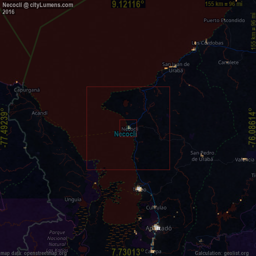
Analysis of Necoclí night lights 2016
Square area 10x10 km:
 0%
0%90-99
0%80-89
0%70-79
0%60-69
0%50-59
1.45%40-49
0.21%30-39
0.83%20-29
0%10-19
0.83%0-9
96.69%Square area 50x50 km:
0%90-99
0%80-89
0%70-79
0%60-69
0%50-59
0.06%40-49
0.01%30-39
0.03%20-29
0%10-19
0.03%0-9
99.87%Clear (daylight) street map image can be seen on geolist.org.
Map coordinates:
9° 7' 16.2" North, 77° 29' 32.6" West
8° 25' 34.6" North, 76° 47' 21.3" West
7° 43' 48.5" North, 76° 5' 10.1" West
Some cities around Necoclí sort by population:
• Apartadó
63 km =39.1 mi,  163°
163°
• Turbo
37.7 km =23.4 mi,  169°
169°
• Carepa
75.8 km =47.1 mi, 168°
• San Pedro de Urabá
48.4 km =30.1 mi,  110°
110°
• San Juan de Urabá
46.7 km =29 mi,  37°
37°
• Valencia
72.8 km =45.2 mi,  104°
104°
• Arboletes
61.7 km =38.3 mi, 40°
• Moñitos
83.7 km =52 mi, 103°
3673974 (p: 10,835)
Sources (retrieved 2019-11-25):
» Earth at Night: Flat Maps 2012, 2016