Caldas night lights from space
Night Light of Caldas (Antioquia) from space (Colombia) Src. Average luminocity for 10x10km area is 25.814% and for 50x50km: 20.2973%.
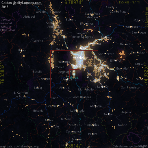
Analysis of Caldas night lights 2016
Square area 10x10 km:
 2.07%
2.07%90-99
2.89%80-89
0%70-79
0.83%60-69
9.92%50-59
6.61%40-49
1.65%30-39
2.89%20-29
11.16%10-19
29.13%0-9
32.85%Square area 50x50 km:
4.92%90-99
3.22%80-89
1.25%70-79
3.34%60-69
2.9%50-59
3.44%40-49
0.95%30-39
2.18%20-29
6.43%10-19
10.29%0-9
61.09%Clear (daylight) street map image can be seen on geolist.org.
Map coordinates:
6° 47' 23.1" North, 76° 20' 19.8" West
6° 5' 27.8" North, 75° 38' 8.5" West
5° 23' 29.3" North, 74° 55' 57.3" West
Some cities around Caldas sort by population:
• Itagüí
11.2 km =7 mi,  21°
21°
• Envigado
10.6 km =6.6 mi,  27°
27°
• La Estrella
7.5 km =4.7 mi,  353°
353°
• Sabaneta
7 km =4.3 mi, 17°
• Amagá
9.4 km =5.8 mi,  232°
232°
• Fredonia
18.8 km =11.7 mi,  191°
191°
• Retiro
15.1 km =9.4 mi,  103°
103°
• Venecia
18.2 km =11.3 mi,  218°
218°
3687952 (p: 65,565)
Sources (retrieved 2019-11-25):
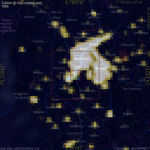
» NASA, Earths city lights 1995
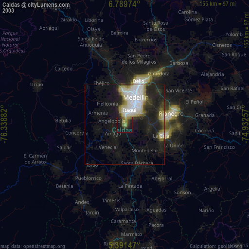
» NASA city lights 2003
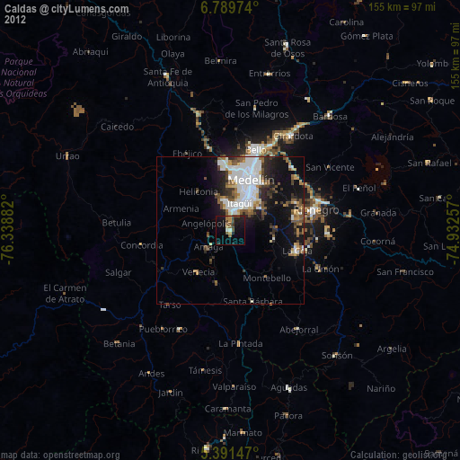
» Earth at Night: Flat Maps 2012, 2016