Facatativá night lights from space
Night Light of Facatativá (Cundinamarca) from space (Colombia) Src. Average luminocity for 10x10km area is 31.1508% and for 50x50km: 16.5724%.
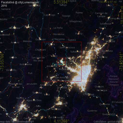
Analysis of Facatativá night lights 2016
Square area 10x10 km:
 3.93%
3.93%90-99
5.99%80-89
2.69%70-79
5.17%60-69
3.93%50-59
2.89%40-49
5.17%30-39
2.27%20-29
5.37%10-19
38.43%0-9
24.17%Square area 50x50 km:
4.01%90-99
2.5%80-89
1.44%70-79
1.82%60-69
1.72%50-59
2.09%40-49
2.74%30-39
2.96%20-29
3.77%10-19
8.57%0-9
68.36%Clear (daylight) street map image can be seen on geolist.org.
Map coordinates:
5° 30' 50.2" North, 75° 3' 27.6" West
4° 48' 49.2" North, 74° 21' 16.3" West
4° 6' 45.6" North, 73° 39' 5.1" West
Some cities around Facatativá sort by population:
• Funza
19.1 km =11.9 mi,  124°
124°
• Madrid
13.5 km =8.4 mi,  132°
132°
• Mosquera
18.3 km =11.4 mi, 131°
• Villeta
25.3 km =15.7 mi,  328°
328°
• Cota
28.4 km =17.6 mi,  90°
90°
• La Vega
21 km =13 mi,  3°
3°
• Anolaima
16.2 km =10.1 mi,  277°
277°
• El Rosal
11.4 km =7.1 mi,  67°
67°
3682516 (p: 94,611)
Sources (retrieved 2019-11-25):
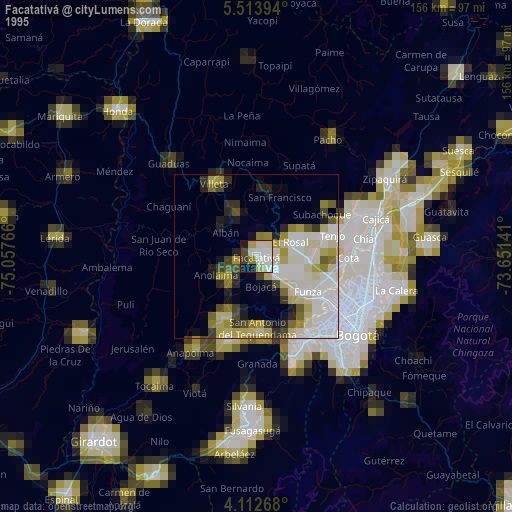
» NASA, Earths city lights 1995
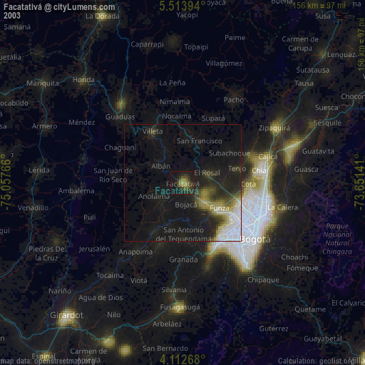
» NASA city lights 2003
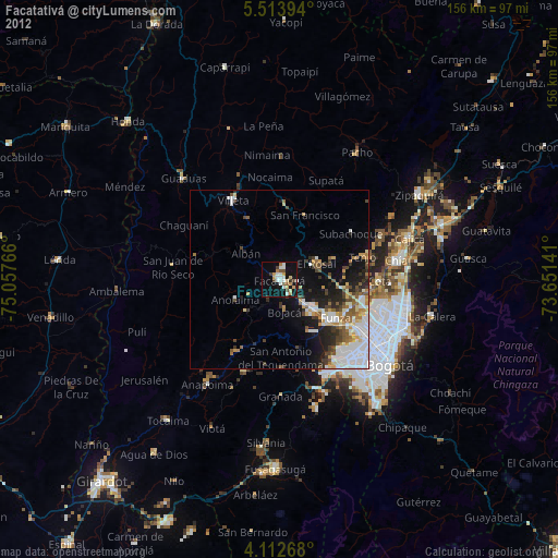
» Earth at Night: Flat Maps 2012, 2016