Villeta night lights from space
Night Light of Villeta (Cundinamarca) from space (Colombia) Src. Average luminocity for 10x10km area is 7.2045% and for 50x50km: 2.7563%.
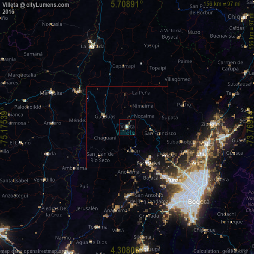
Analysis of Villeta night lights 2016
Square area 10x10 km:
 0.41%
0.41%90-99
1.65%80-89
0.41%70-79
1.65%60-69
0.41%50-59
2.07%40-49
1.03%30-39
1.45%20-29
0%10-19
0.83%0-9
90.08%Square area 50x50 km:
0.24%90-99
0.39%80-89
0.16%70-79
0.28%60-69
0.37%50-59
0.56%40-49
0.42%30-39
0.72%20-29
0.43%10-19
2.72%0-9
93.71%Clear (daylight) street map image can be seen on geolist.org.
Map coordinates:
5° 42' 32.1" North, 75° 10' 31.4" West
5° 0' 31.9" North, 74° 28' 20.1" West
4° 18' 29" North, 73° 46' 8.9" West
Some cities around Villeta sort by population:
• Facatativá
25.3 km =15.7 mi,  148°
148°
• Madrid
38.4 km =23.9 mi,  143°
143°
• Honda
36.7 km =22.8 mi,  307°
307°
• Pacho
37.3 km =23.2 mi,  68°
68°
• Guaduas
15 km =9.3 mi,  295°
295°
• La Vega
14.5 km =9 mi,  93°
93°
• Anolaima
19.7 km =12.2 mi,  188°
188°
• El Rosal
29.2 km =18.1 mi,  126°
126°
3665895 (p: 20,689)
Sources (retrieved 2019-11-25):
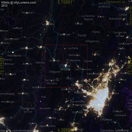
» Earth at Night: Flat Maps 2012, 2016