Anolaima night lights from space
Night Light of Anolaima (Cundinamarca) from space (Colombia) Src. Average luminocity for 10x10km area is 0.5351% and for 50x50km: 4.4703%.
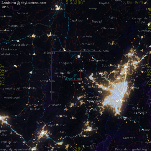
Analysis of Anolaima night lights 2016
Square area 10x10 km:
 0%
0%90-99
0%80-89
0%70-79
0%60-69
0%50-59
0.83%40-49
0%30-39
0%20-29
0%10-19
0%0-9
99.17%Square area 50x50 km:
0.24%90-99
0.51%80-89
0.35%70-79
0.57%60-69
0.52%50-59
0.77%40-49
0.8%30-39
1.11%20-29
0.75%10-19
4.5%0-9
89.87%Clear (daylight) street map image can be seen on geolist.org.
Map coordinates:
5° 32' 1.9" North, 75° 12' 9.5" West
4° 50' 1" North, 74° 29' 58.2" West
4° 7' 57.5" North, 73° 47' 47" West
Some cities around Anolaima sort by population:
• Facatativá
16.2 km =10.1 mi,  97°
97°
• Funza
34.4 km =21.4 mi,  112°
112°
• Madrid
28.4 km =17.6 mi, 113°
• Mosquera
33 km =20.5 mi,  115°
115°
• Villeta
19.7 km =12.2 mi,  8°
8°
• Guaduas
28 km =17.4 mi,  337°
337°
• La Vega
25.6 km =15.9 mi,  43°
43°
• El Rosal
26.6 km =16.5 mi,  85°
85°
3689841 (p: 5,585)
Sources (retrieved 2019-11-25):
» Earth at Night: Flat Maps 2012, 2016