Circasia night lights from space
Night Light of Circasia (Quindío) from space (Colombia) Src. Average luminocity for 10x10km area is 13.562% and for 50x50km: 11.6021%.
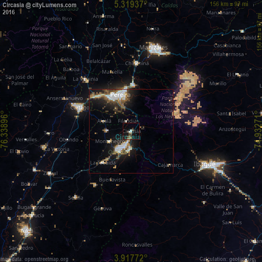
Analysis of Circasia night lights 2016
Square area 10x10 km:
 0.83%
0.83%90-99
1.65%80-89
0.41%70-79
0.41%60-69
2.27%50-59
2.27%40-49
3.51%30-39
2.69%20-29
2.48%10-19
14.26%0-9
69.21%Square area 50x50 km:
1.93%90-99
1.87%80-89
0.76%70-79
1.05%60-69
1.47%50-59
1.71%40-49
2.15%30-39
2.01%20-29
2.62%10-19
8.63%0-9
75.79%Clear (daylight) street map image can be seen on geolist.org.
Map coordinates:
5° 19' 9.7" North, 76° 20' 20.3" West
4° 37' 8" North, 75° 38' 9" West
3° 55' 3.8" North, 74° 55' 57.8" West
Some cities around Circasia sort by population:
• Pereira
22.6 km =14 mi,  342°
342°
• Armenia
10.7 km =6.6 mi,  207°
207°
• Dosquebradas
24.7 km =15.3 mi,  351°
351°
• Calarcá
10 km =6.2 mi,  183°
183°
• Montenegro
14 km =8.7 mi,  245°
245°
• Quimbaya
14.1 km =8.8 mi,  271°
271°
• Alcalá
17.4 km =10.8 mi,  290°
290°
• Filandia
6.7 km =4.2 mi, 338°
3686233 (p: 20,113)
Sources (retrieved 2019-11-25):
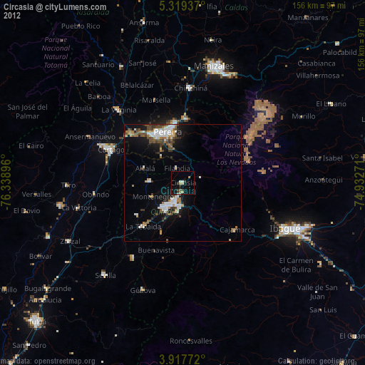
» Earth at Night: Flat Maps 2012, 2016