Calarcá night lights from space
Night Light of Calarcá (Quindío) from space (Colombia) Src. Average luminocity for 10x10km area is 40.6178% and for 50x50km: 6.4973%.
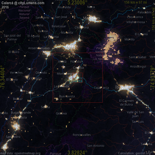
Analysis of Calarcá night lights 2016
Square area 10x10 km:
 8.68%
8.68%90-99
7.64%80-89
4.75%70-79
3.93%60-69
5.79%50-59
5.79%40-49
3.1%30-39
5.37%20-29
12.19%10-19
24.79%0-9
17.98%Square area 50x50 km:
0.76%90-99
0.84%80-89
0.47%70-79
0.76%60-69
0.65%50-59
0.92%40-49
1.15%30-39
1.32%20-29
1.37%10-19
5.33%0-9
86.42%Clear (daylight) street map image can be seen on geolist.org.
Map coordinates:
5° 13' 48.2" North, 76° 20' 38.5" West
4° 31' 46.2" North, 75° 38' 27.3" West
3° 49' 41.7" North, 74° 56' 16" West
Some cities around Calarcá sort by population:
• Armenia
4.5 km =2.8 mi,  276°
276°
• Montenegro
12.9 km =8 mi,  288°
288°
• Quimbaya
17 km =10.6 mi,  307°
307°
• La Tebaida
18.4 km =11.4 mi,  242°
242°
• Circasia
10 km =6.2 mi,  3°
3°
• Alcalá
22.5 km =14 mi,  315°
315°
• Filandia
16.3 km =10.1 mi,  353°
353°
• Pijao
22.9 km =14.2 mi,  197°
197°
3687964 (p: 62,170)
Sources (retrieved 2019-11-25):
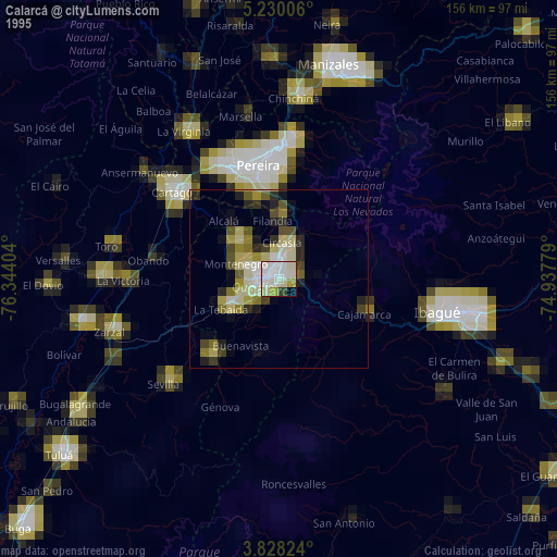
» NASA, Earths city lights 1995
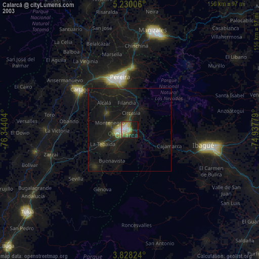
» NASA city lights 2003
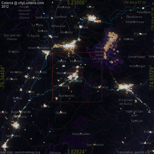
» Earth at Night: Flat Maps 2012, 2016