Armenia night lights from space
Night Light of Armenia (Quindío) from space (Colombia) Src. Average luminocity for 10x10km area is 57.4773% and for 50x50km: 6.793%.
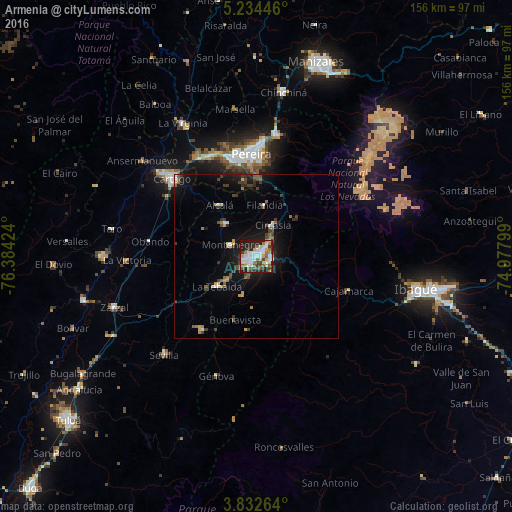
Analysis of Armenia night lights 2016
Square area 10x10 km:
 14.67%
90-99
13.64%80-89
5.99%70-79
5.58%60-69
6.61%50-59
7.85%40-49
5.79%30-39
7.64%20-29
19.63%10-19
12.6%0-9
0%Square area 50x50 km:
0.82%90-99
0.87%80-89
0.45%70-79
0.78%60-69
0.69%50-59
1.06%40-49
1.13%30-39
1.36%20-29
1.5%10-19
5.88%0-9
85.44%Clear (daylight) street map image can be seen on geolist.org.
Map coordinates:
5° 14' 4.1" North, 76° 23' 3.3" West
4° 32' 2" North, 75° 40' 52" West
3° 49' 57.5" North, 74° 58' 40.8" West
Some cities around Armenia sort by population:
• Calarcá
4.5 km =2.8 mi,  96°
96°
• Montenegro
8.6 km =5.3 mi,  294°
294°
• Quimbaya
13.4 km =8.3 mi,  317°
317°
• La Tebaida
14.9 km =9.3 mi,  232°
232°
• Circasia
10.7 km =6.6 mi,  27°
27°
• Alcalá
19.3 km =12 mi, 324°
• Filandia
15.9 km =9.9 mi,  9°
9°
• Pijao
22.4 km =13.9 mi,  186°
186°
3689560 (p: 315,328)
Sources (retrieved 2019-11-25):
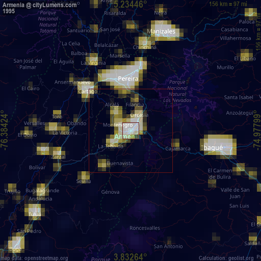
» NASA, Earths city lights 1995
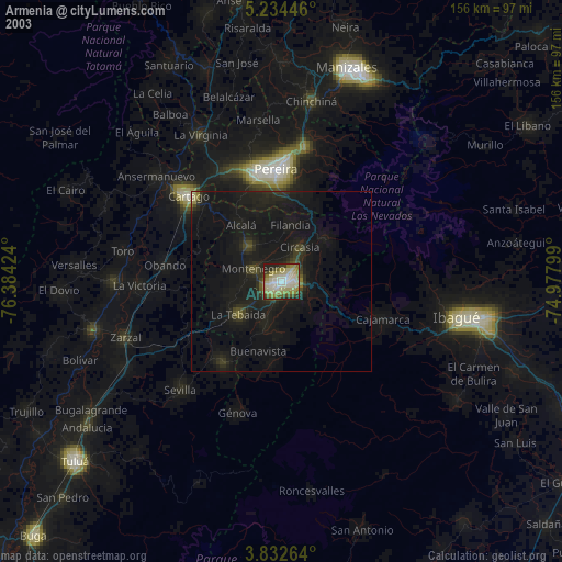
» NASA city lights 2003
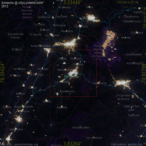
» Earth at Night: Flat Maps 2012, 2016