Cali night lights from space
Night Light of Cali (Valle del Cauca) from space (Colombia) Src. Average luminocity for 10x10km area is 97.1147% and for 50x50km: 32.4194%.
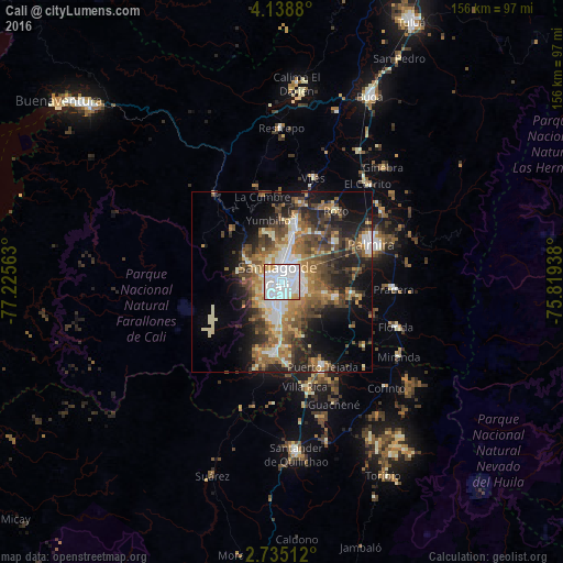
Analysis of Cali night lights 2016
Square area 10x10 km:
 61.04%
90-99
27.92%80-89
3.68%70-79
6.49%60-69
0.87%50-59
0%40-49
0%30-39
0%20-29
0%10-19
0%0-9
0%Square area 50x50 km:
5.24%90-99
5.3%80-89
3.06%70-79
4.02%60-69
5.95%50-59
5.69%40-49
6.56%30-39
5.54%20-29
7.9%10-19
12.48%0-9
38.27%Clear (daylight) street map image can be seen on geolist.org.
Map coordinates:
4° 8' 19.7" North, 77° 13' 32.3" West
3° 26' 14" North, 76° 31' 21" West
2° 44' 6.4" North, 75° 49' 9.8" West
Some cities around Cali sort by population:
• Palmira
26.8 km =16.7 mi,  64°
64°
• Yumbo
16.5 km =10.3 mi,  12°
12°
• Puerto Tejada
25.7 km =16 mi,  152°
152°
• Florida
34.4 km =21.4 mi,  111°
111°
• Jamundí
19.7 km =12.2 mi,  184°
184°
• Pradera
30.9 km =19.2 mi,  93°
93°
• Candelaria
19.6 km =12.2 mi,  99°
99°
• Dagua
30.6 km =19 mi,  322°
322°
3687925 (p: 2,392,877)
Sources (retrieved 2019-11-25):
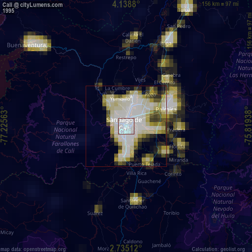
» NASA, Earths city lights 1995
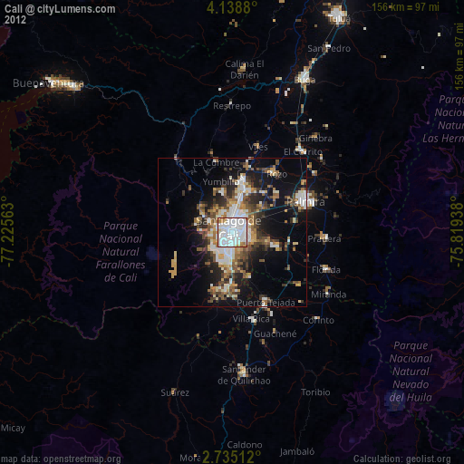
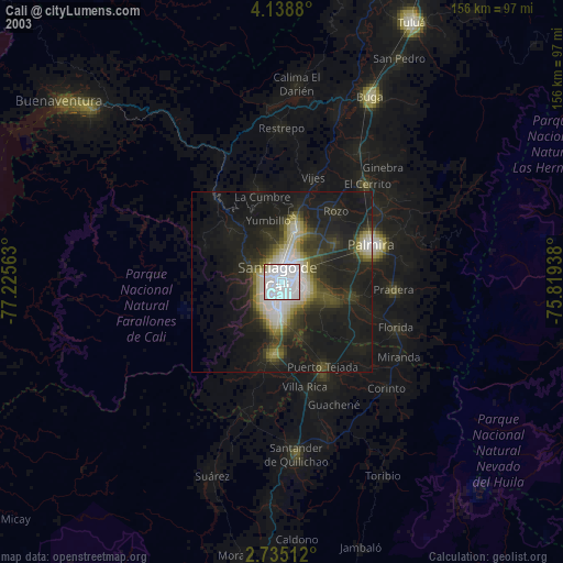
» NASA city lights 2003
» Earth at Night: Flat Maps 2012, 2016