Belalcázar night lights from space
Night Light of Belalcázar (Cauca) from space (Colombia) Src. Average luminocity for 10x10km area is 0.513% and for 50x50km: 0.1168%.
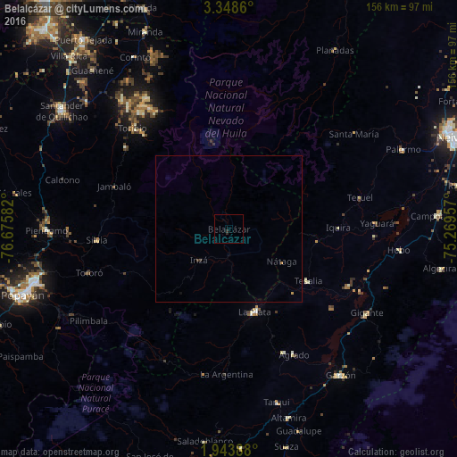
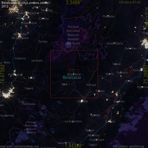
Analysis of Belalcázar night lights 2016
Square area 10x10 km:
 0%
0%90-99
0%80-89
0%70-79
0%60-69
0%50-59
0%40-49
0%30-39
0%20-29
1.73%10-19
0%0-9
98.27%Square area 50x50 km:
0%90-99
0%80-89
0%70-79
0.03%60-69
0.03%50-59
0%40-49
0%30-39
0.07%20-29
0.07%10-19
0.03%0-9
99.76%Clear (daylight) street map image can be seen on geolist.org.
Map coordinates:
3° 20' 55" North, 76° 40' 33" West
2° 38' 47.2" North, 75° 58' 21.7" West
1° 56' 38" North, 75° 16' 10.5" West
Some cities around Belalcázar sort by population:
• Piendamo
62 km =38.5 mi,  269°
269°
• Garzón
63.1 km =39.2 mi,  142°
142°
• La Plata
29.5 km =18.3 mi,  162°
162°
• Gaitania
58.6 km =36.4 mi,  17°
17°
• Gigante
55.4 km =34.4 mi,  121°
121°
• Silvia
45.7 km =28.4 mi, 265°
• Caloto
64.9 km =40.3 mi,  311°
311°
• Yaguará
50.6 km =31.4 mi,  87°
87°
3673398 (p: 31,800)
Sources (retrieved 2019-11-25):
» Earth at Night: Flat Maps 2012, 2016