Ancuya night lights from space
Night Light of Ancuya (Nariño) from space (Colombia) Src. Average luminocity for 10x10km area is 2.6905% and for 50x50km: 3.5108%.
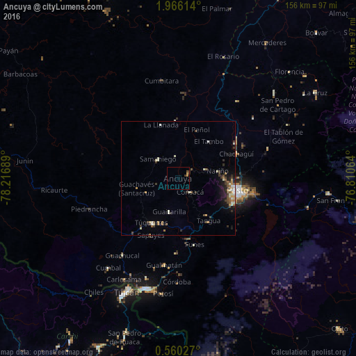
Analysis of Ancuya night lights 2016
Square area 10x10 km:
 0%
0%90-99
0%80-89
0.43%70-79
1.3%60-69
0%50-59
0.87%40-49
0%30-39
1.73%20-29
0%10-19
0%0-9
95.67%Square area 50x50 km:
0.14%90-99
0.79%80-89
0.42%70-79
0.34%60-69
0.47%50-59
0.45%40-49
0.64%30-39
0.87%20-29
0.61%10-19
1.9%0-9
93.38%Clear (daylight) street map image can be seen on geolist.org.
Map coordinates:
1° 57' 58.1" North, 78° 13' 0.8" West
1° 15' 47.9" North, 77° 30' 49.5" West
0° 33' 37" North, 76° 48' 38.3" West
Some cities around Ancuya sort by population:
• Pasto
26.4 km =16.4 mi,  102°
102°
• Túquerres
22.9 km =14.2 mi,  210°
210°
• Samaniego
12.4 km =7.7 mi,  312°
312°
• Sandoná
5.6 km =3.5 mi,  62°
62°
• Olaya Herrera
3.1 km =1.9 mi,  123°
123°
• El Tambo
21 km =13 mi,  40°
40°
• Pupiales
45.8 km =28.5 mi,  197°
197°
• Guaitarilla
15.2 km =9.4 mi,  194°
194°
3689915 (p: 5,852)
Sources (retrieved 2019-11-25):
» Earth at Night: Flat Maps 2012, 2016