Astrea night lights from space
Night Light of Astrea (Cesar) from space (Colombia) Src. Average luminocity for 10x10km area is 2.2273% and for 50x50km: 0.2145%.
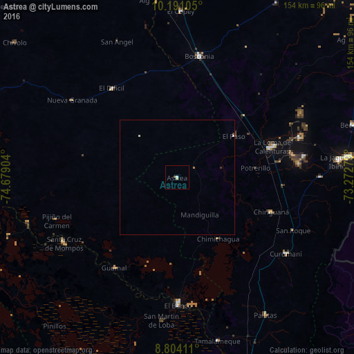
Analysis of Astrea night lights 2016
Square area 10x10 km:
 0.43%
0.43%90-99
0.43%80-89
0.87%70-79
0%60-69
0%50-59
0.87%40-49
0%30-39
0%20-29
0%10-19
0%0-9
97.4%Square area 50x50 km:
0.03%90-99
0.08%80-89
0.03%70-79
0%60-69
0.03%50-59
0.03%40-49
0.03%30-39
0.03%20-29
0%10-19
0%0-9
99.73%Clear (daylight) street map image can be seen on geolist.org.
Map coordinates:
10° 11' 27.8" North, 74° 40' 44.5" West
9° 29' 53.8" North, 73° 58' 33.3" West
8° 48' 14.8" North, 73° 16' 22" West
Some cities around Astrea sort by population:
• El Banco
55.3 km =34.4 mi,  179°
179°
• Mompós
57.1 km =35.5 mi,  240°
240°
• Curumaní
58 km =36 mi,  124°
124°
• Chimichagua
32.2 km =20 mi,  146°
146°
• Chiriguaná
43.6 km =27.1 mi,  110°
110°
• Guamal
47.9 km =29.8 mi,  214°
214°
• El Paso
30.7 km =19.1 mi,  54°
54°
• Pijiño del Carmen
55.6 km =34.5 mi,  250°
250°
3689458 (p: 8,995)
Sources (retrieved 2019-11-25):
» Earth at Night: Flat Maps 2012, 2016