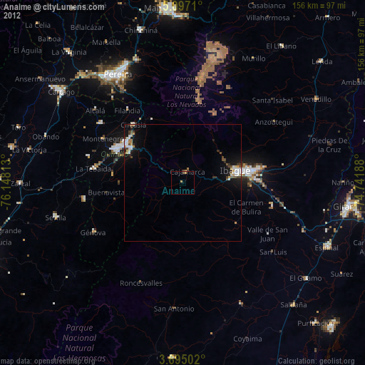
Anaime night lights from space
Night Light of Anaime (Tolima) from space (Colombia) Src. Average luminocity for 10x10km area is 1.0227% and for 50x50km: 3.3832%.
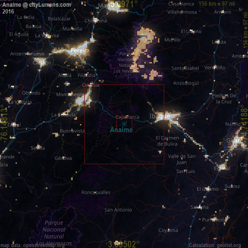
Analysis of Anaime night lights 2016
Square area 10x10 km:
100  0%
0%
90-99 0%
80-89 0.21%
70-79 0.21%
60-69 0%
50-59 0%
40-49 0.83%
30-39 0.41%
20-29 0%
10-19 0%
0-9 98.35%
0%90-99
0%80-89
0.21%70-79
0.21%60-69
0%50-59
0%40-49
0.83%30-39
0.41%20-29
0%10-19
0%0-9
98.35%Square area 50x50 km:
100 0.53%
90-99 0.56%
80-89 0.36%
70-79 0.31%
60-69 0.39%
50-59 0.19%
40-49 0.56%
30-39 0.59%
20-29 0.8%
10-19 3.16%
0-9 92.55%
0.53%90-99
0.56%80-89
0.36%70-79
0.31%60-69
0.39%50-59
0.19%40-49
0.56%30-39
0.59%20-29
0.8%10-19
3.16%0-9
92.55%Clear (daylight) street map image can be seen on geolist.org.
Map coordinates:
5° 5' 49.6" North, 76° 8' 53.3" West
4° 23' 47" North, 75° 26' 42" West
3° 41' 42.1" North, 74° 44' 30.8" West
Some cities around Anaime sort by population:
• Ibagué
24.1 km =15 mi,  78°
78°
• Armenia
30.3 km =18.8 mi,  300°
300°
• Calarcá
26.3 km =16.3 mi, 304°
• Circasia
32.5 km =20.2 mi,  319°
319°
• Coello
16.7 km =10.4 mi,  87°
87°
• Cajamarca
5.4 km =3.4 mi,  19°
19°
• Rovira
28.7 km =17.8 mi,  127°
127°
• Pijao
29.6 km =18.4 mi,  256°
256°
3689952 (p: 25,715)
Sources (retrieved 2019-11-25):
» Earth at Night: Flat Maps 2012, 2016